Baby Buried With Care 10,000 Years Ago Found in Italian Cave
Archaeologists studying a cave in Liguria, Italy, have found the earliest known burial of a female infant in Europe. Surrounded by grave goods, the baby, whom the researchers dubbed “Neve” in honor of a nearby river, was 40 to 50 days old when she died about 10,000 years ago, reports Brian P. Dunleavy for United Press International (UPI).
Archaeologists unearthed the body of a female infant at a 10,000-year-old burial site in the Arma Veirana cave in Italy.
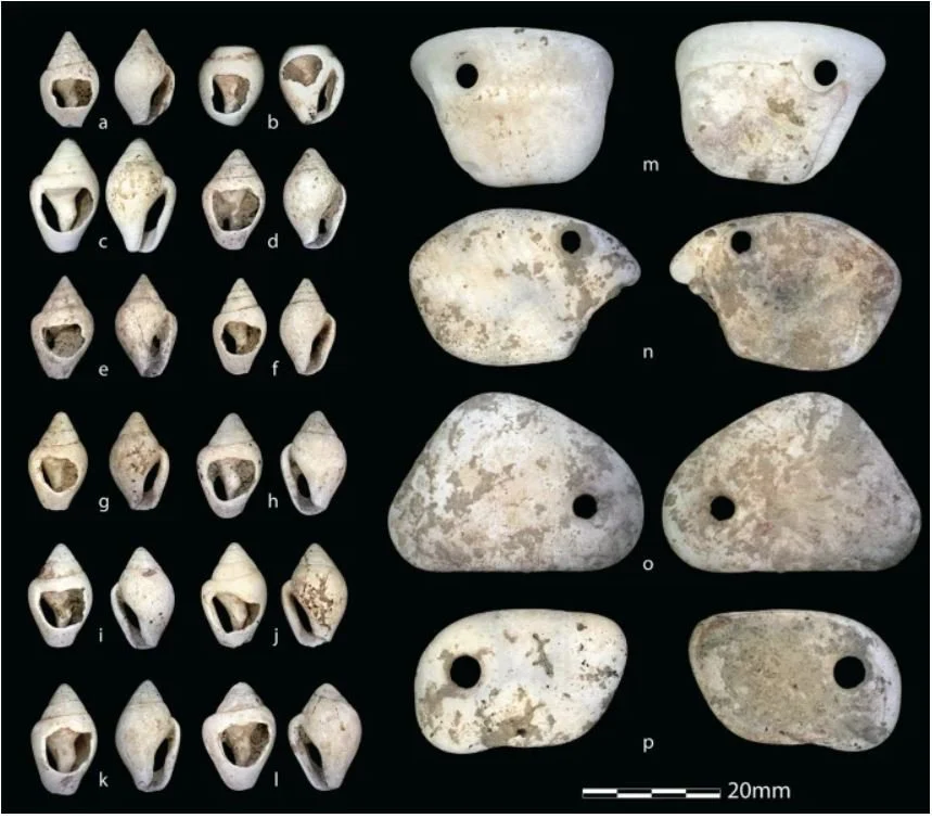
The child’s remains were wrapped in a shroud adorned with more than 60 beads and four pendants, all of which were made out of shells. An eagle-owl talon that may have been a gift was discovered nearby.
As the team argues in the journal Scientific Reports, the burial reflects the infant’s treatment as a full person by an early Mesolithic hunter-gatherer culture, with the items buried alongside her indicating significant emotional investment.
Finding the bones of babies from prehistoric or ancient times is rare because they’re extremely fragile, reports Tom Metcalfe for National Geographic. The new discovery is especially unusual because the remains were preserved well enough to extract DNA. In most cases, infants’ bone DNA has deteriorated too much to determine sex.
Adult burials dated to more than 14,000 years ago are somewhat common archaeological finds. But examples from the early Mesolithic (around 10,000 B.C.E.) are few and far between.
The remains of the infant, nicknamed “Neve” after a nearby river, were found together with grave goods. The intricate style of burial marks the full personhood afforded to the baby by her hunter-gatherer community.
“The number of burials at this time, between about 10,000 and 11,000 years ago, is very, very rare,” lead author Jamie Hodgkins, an archaeologist at the University of Colorado, tells National Geographic. “… [I]t’s in a gap where we don’t have much of anything at all.”
Neve’s grave is located in the Arma Veirana cave in the mountains of Liguria, a region in northwestern Italy. A popular spot for visitors, the site is also a target for thieves. The researchers began studying the cave in 2015 after looters exposed late Ice Age tools there, writes Ian Randall for the Daily Mail.
Signs of activity in the cave date back more than 50,000 years, to a time when its most likely inhabitants would have been Neanderthals. Archaeologists found boar and elk bones that showed signs of butchering, as well as charred animal fat. After digging deeper into the cave in 2017, the team found the infant’s burial site.
“I was excavating in the adjacent square and remember looking over and thinking, ‘That’s a weird bone,’” says study co-author Claudine Gravel-Miguel, an archaeologist at the Institute of Human Origins at Arizona State University, in a statement.
The team fully excavated the gravesite in 2018. The ornaments buried with Neve were made with care; judging from patterns of wear, they were probably passed down to the child by other members of her community.
“The presence of perforated shells with traces of prolonged use means that these have been worn for a long time by the adults,” study co-author Fabio Negrino, an archaeologist at the University of Genoa, tells Rachel Elbaum of NBC News. “These shells were perhaps sewn to her dress.”
Neve’s remains were wrapped in a shroud adorned with beads and pendants made of shells. The talon of an eagle-owl was buried along side her as a supposed gift.
Tests conducted on the infant’s teeth revealed details of her short life. According to the study, carbon and nitrogen analysis found that before she was born, her mother ate a land-based diet. Neve experienced stress in the womb that led her teeth to temporarily stop growing. DNA and protein tests showed that she belonged to a European lineage known as the U5b2b haplogroup.
Researchers compared the find to the remains of two infants buried at Upward Sun River in Alaska some 11,500 years ago and rediscovered in 2013. In both cases, the infant girls appear to have been recognized as people in their own right.
This acknowledgement of personhood may have stemmed from a common ancestral culture, write the authors in the study. Alternatively, it could have arisen independently.
María Martinón-Torres, a paleoanthropologist who was not involved in the study, tells National Geographic that evidence of children’s personhood dates back to the early Homo sapiens and Neanderthal periods.
She adds, “The earliest documented burials in Africa … involve children and a deliberate dedication to the way the body is disposed.”
In a separate statement, Hodgkins says, “Archaeological reports have tended to focus on male stories and roles, and in doing so have left many people out of the narrative. … Without DNA analysis, this highly decorated infant burial could possibly have been assumed male.”
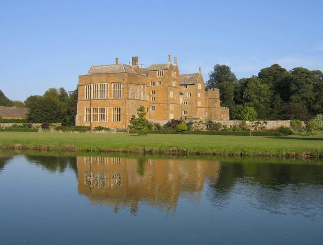
The oldest house in the UK is nearly 6000 years old and has stone furniture that is still intact today
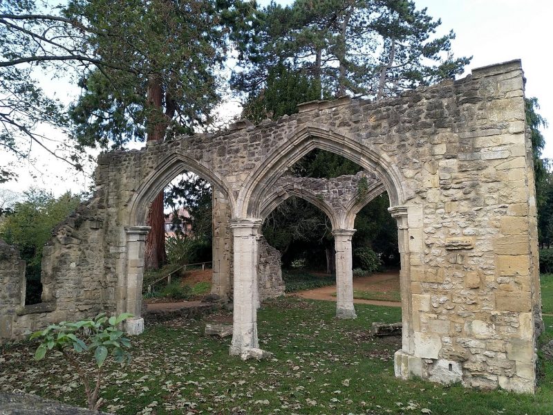
At Knap of Howar on the island of Papa Westray in Orkney, Scotland, a Neolithic farmstead may be the oldest preserved stone house in northern Europe.
Radiocarbon dating shows that it was occupied from 3700 BC to 2800 BC, earlier than the similar houses in the settlement at Skara Brae on the Orkney Mainland.
The front of the structures.
The farmstead consists of two adjacent rounded rectangular thick-walled buildings with very low doorways facing the sea. The larger and older structure is linked by a low passageway to the other building, which has been interpreted as a workshop or a second house.
They were constructed on an earlier midden, and were surrounded by midden material which has protected them. There are no windows; the structures were presumably lit by fire, with a hole in the roof to let out smoke.
Though they now stand close to the shore, they would have originally lain inland. The shore shows how the local stone splits into thin slabs, giving a ready source of construction material.
The main house now looks out over the sea.
The walls still stand to an eaves height of 1.6 metres (5 ft 3 in), and the stone furniture is intact giving a vivid impression of life in the house. Fireplaces, partition screens, beds and storage shelves are almost intact, and post holes were found indicating the roof structure.
Looking back through the low entrance doorway into the main house, a visitor’s backpack gives an idea of scale.
Evidence from the middens shows that the inhabitants were keeping cattle, sheep and pigs, cultivating barley and wheat and gathering shellfish as well as fishing for species which have to be line caught using boats.
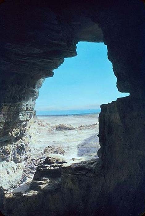
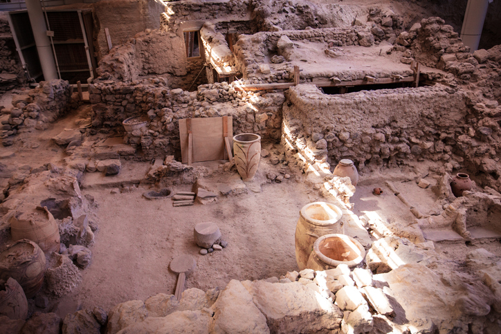
Skeletons Found Near Dead Sea Scrolls Likely Belonged to an Enigmatic Religious Group
The discovery of the Dead Sea Scrolls is regarded as one of the greatest archaeological finds in history. Almost as interesting as the content of the texts themselves has been the question of who created and cared for them.
A recent analysis of skeletons found near the site and dating to the same time period suggests the common assumption of an enigmatic religious group known as the Essenes may be correct.
The belief that people living in Qumran at the time of the Dead Sea Scrolls creation were members of a celibate Jewish sect called the Essenes is one of the earliest and also the most popular.
These men were said to be the creators or caretakers of the famed scrolls. However, IBTimes notes Bedouin herders, craftsmen, and Roman soldiers have also been proposed as possible inhabitants of Qumran at that time.
ScienceNews reports that a recent evaluation of 33 skeletons buried at Qumran supports the popular belief that the community was comprised of religious men. The analysis focused on examining physical factors, including pelvic shape and body sizes, and concluded that it is highly probable only men and children were present at the site.
Three of the skeletons could not be identified as male or female. This is a change from the previous assessment that seven of the skeletons were female.
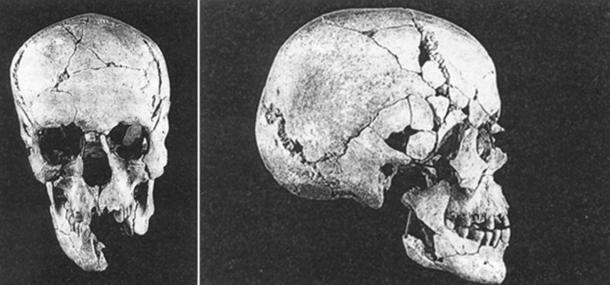
Skulls found at Qumran.
Radiocarbon dating of one of the Qumran skeleton’s bones places the body at approximately 2,200 years old. This is close to the time when the Dead Sea Scrolls are estimated to have been written – 150 BC to 70 AD.
The estimated age of death for the men ranged from around 20 to 50 years old. The lack of war-related injuries goes against the soldier hypothesis. Anthropologist Yossi Nagar of the Israel Antiquities Authority in Jerusalem said that the men cannot be confirmed as Essenes, but the belief is probable.
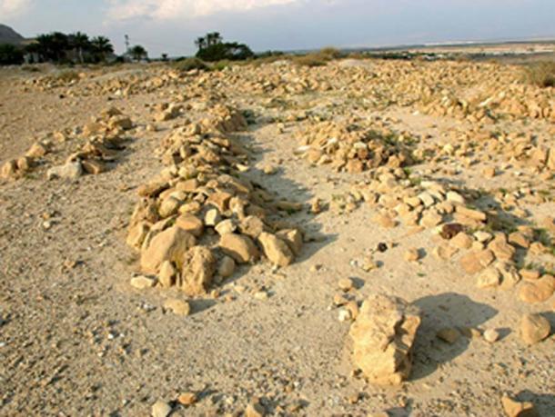
Section of the Qumran cemetery.
Judaism that left Jerusalem in protest against the Romans and the way things were happening at the Temple. They apparently went into the desert to follow the orders of the prophet Isaiah. This religious group has often been linked to the Dead Sea Scrolls.
Small samples of bone were removed from some of the Qumran skeletons, so there is a chance that researchers could try to complete DNA analysis and perhaps find more clear evidence of who the people living near the Dead Sea Scrolls were. However, Nagar is uncertain if this type of study will be completed.
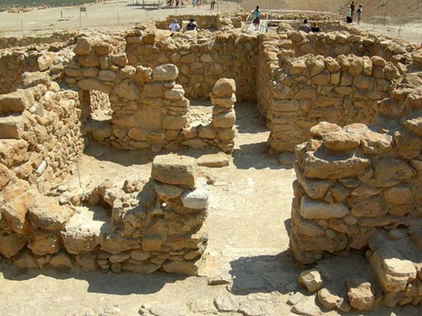
Remains of living quarters at Qumran.
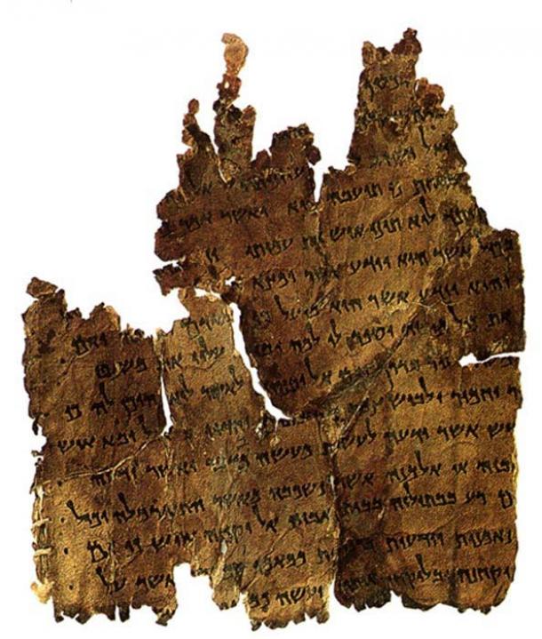
The Dead Sea Scrolls were found in 11 caves at Qumran between 1947 and 1956. The set of nearly 1000 manuscripts provide some of the earliest versions of the Hebrew Bible.
A 12th cave was discovered in February 2017, but only scroll jars, fragments of scroll wrappings, and a piece of worked leather were discovered.
View of the Dead Sea from a Cave at Qumran.
The first Dead Sea Scrolls were found unintentionally by a Bedouin shepherd at a cave in the vicinity of Qumran. As more texts surfaced over the years, several were put on sale on the black market to private buyers.
This issue led the Israel Antiquities Authority and the Heritage Project to excavate in the Judean Desert Caves in 2016 at the Cave of Skulls – a difficult location to reach. Israel Hasson, director-general of the Israel Antiquities Authority, explained the urgency to find the last Dead Sea Scrolls.
A fragment from the Dead Sea Scrolls collection known as the Damascus document.
Incredible sophistication of 5,000-year-old temple complex on Orkney Island
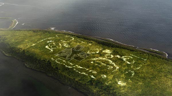
In 2014, a groundbreaking excavation of a prehistoric temple complex on the Scottish island of Orkney revealed that the Neolithic inhabitants of the island were far more advanced than initially realised.
As well as a large collection of ancient artifacts that reflect a complex and culturally-rich society, archaeologists also discovered that the three major monumental structures on the island – the Ring of Brodgar, the Stones of Stennes, and the Maes Howe tomb – were “inextricably linked in some grand theme”.
The archaeological site, known as the Ness of Brodgar, covers an area of over 6 acres and consists of the remains of housing, remnants of slate roofs, paved walkways, coloured facades, decorated stone slabs, a massive stone wall with foundations, and a large building described as a Neolithic ‘cathedra’ or ‘palace’, inhabited from at least 3,500 BC to the close of the Neolithic period more than a millennium and a half later.
“Their workmanship was impeccable. The imposing walls they built would have done credit to the Roman centurions who, some 30 centuries later, would erect Hadrian’s Wall in another part of Britain.
Cloistered within those walls were dozens of buildings, among them one of the largest roofed structures built in prehistoric northern Europe. It was more than 80ft long and 60ft wide, with walls 13ft thick,” said Roff Smith, author of an article on the Ness of Brodgar to be released in the August edition of National Geographic.
The archaeological site at the Ness of Brodgar.
A reconstruction of what the site once looked like.
The archaeological excavation, which has so far only unearthed around 10 per cent of the original site, has yielded thousands of incredible artifacts including ceremonial mace heads, polished stone axes, flint knives, a human figurine, miniature thumb pots, beautifully crafted stone spatulas, highly-refined coloured pottery, and more than 650 pieces of Neolithic art, by far the largest collection ever found in Britain.
An engraved stone from the Ness of Brodgar.
The monumental sites of the Ring of Brodgar, the Stones of Stenness, and the Maes Howe tomb, all located within several miles of the Ness, used to be seen as isolated monuments with separate histories, but as excavations at the Ness have progressed, archaeologists have come to believe that the megalithic sites in the surrounding region were all connected in some way with the Ness of Brodgar, although its purpose remains unknown.
“What the Ness is telling us is that this was a much more integrated landscape than anyone ever suspected,” said archaeologist Nick Card, excavation director with the Archaeology Institute at the University of the Highlands and Islands.
“All these monuments are inextricably linked in some grand theme we can only guess at. The people who built all this were a far more complex and capable society than has usually been portrayed.”
The Ring of Brodgar.
“Stand at the Ness today and several iconic Stone Age structures are within easy view, forming the core of a World Heritage site called the Heart of Neolithic Orkney,” said Smith.
“The Ness of Brodgar appears to be the anchor piece – the showpiece, if you will – that links these other great monuments into one great monumental landscape of a sort nobody had dreamed existed. And to have had it lying underfoot, unsuspected, for so many centuries only adds to the sense of wonder surrounding its discovery.
Roman-Era ‘Mega Villa’ Bigger than the Taj Mahal Discovered in England
The remains of a huge Roman villa dated to 99 AD have been discovered in Oxfordshire, the second largest Roman villa that has ever been found in England.
Archaeologists excavated the remains of the historic building, which is believed to be bigger than the mausoleum at the Taj Mahal, as part of a four-month-long excavation project.
The foundation measures 278 feet by 278 feet. The findings so far include coins and boar tusks alongside a sarcophagus that contains the skeletal remains of an unnamed woman.
Oxfordshire, UK.
“Amateur detectorist and historian Keith Westcott discovered the ancient remains beneath a crop in a field near Broughton Castle near Banbury,” according to HisTech.
Westcott, 55, decided to investigate the site after hearing that a local farmer, John Taylor, had plowed his tractor into a large stone in 1963. Taylor said he saw a hole had been made in the stone and when he reached inside, he pulled out a human bone.
Broughton Castle.
This was the woman’s body — experts believe she died in the 3rd century. The land previously belonged to Lord and Lady Saye and Sele, the parents of Martin Fiennes, who now owns the land.
The Daily Mail reports that Martin Fiennes “works as a principal at Oxford Sciences Innovation and is second cousin of British explorer Ranulph Fiennes and third cousin of actors Ralph and Joseph Fiennes.”
Excavation site
According to the Daily Mail, Westcott had a “eureka moment” when he found “a 1,800 year-old tile from a hypocaust system, which was an early form of central heating used in high-status Roman buildings.”
Using X-ray technology such as magnetometry, the walls, room outlines, ditches, and other infrastructures were revealed. The villa’s accommodation would have included a bath-house with a domed roof, mosaics, a grand dining room, and kitchens.
The largest Roman villa previously found in England is the Fishbourne Palace in West Sussex, which dates back to 75 AD.
Archaeological excavation
The palace at Fishbourne was one of the most noteworthy structures in Roman Britain. Only discovered in the 1960s, the site has been extensively excavated, revealing that it was originally a military site. Lying close to the sea, Fishbourne was ideal as a depot to support Roman campaigns in the area.
Built on four sides around a central garden, the site covered about two hectares, which is the size of two soccer fields. The building itself had about 100 rooms, many with mosaics.
The best known mosaic is the Cupid on a Dolphin. Some of the red stones are made from pieces of red gloss pottery, most likely imported from Gaul.
The Romans invaded Britain in 43 AD, during the reign of Claudius. For the Claudian invasion, an army of 40,000 professional soldiers — half citizen-legionaries, half auxiliaries recruited on the wilder fringes of the empire — were landed in Britain under the command of Aulus Plautius.
Archaeologists debate where they landed. It could have been Richborough in Kent, Chichester in Sussex, or perhaps both. Somewhere, perhaps on the River Medway, they fought a great battle and defeated the Catuvellauni, the tribe that dominated the southeast.
Incredible amount of WWII battlefield relics still being found on the Eastern Front
The war on the Eastern Front, known to Russians as the “Great Patriotic War”, was the scene of the largest military confrontation in history.
Over the course of four years, more than 400 Red Army and German divisions clashed in a series of operations along a front that extended more than 1,000 miles.
Some 27 million Soviet soldiers and civilians and nearly 4 million German troops lost their lives along the Eastern Front during those years of brutality.
The warfare there was total and ferocious, encompassing the largest armored clash in history (Battle of Kursk) and the most costly siege on a modern city (nearly 900 days in Leningrad), as well as scorched earth policies, utter devastation of thousands of villages, mass deportations, mass executions, and countless atrocities attributed to both sides.
The war was fought between Nazi Germany, its allies and Finland, against the Soviet Union.The conflict began on 22 June 1941 with the Operation Barbarossa offensive, whenAxis forces crossed the borders described in the German–Soviet Nonaggression Pact, thereby invading the Soviet Union.
The war ended on 9 May 1945, when Germany’s armed forces surrendered unconditionally following the Battle of Berlin (also known as the Berlin Offensive), a strategic operation executed by the Red Army.
The states that provided forces and other resources for the German war effort included the Axis Powers – primarily Romania, Hungary, Italy, pro-Nazi Slovakia, and Croatia.
The anti-Soviet Finland, which had fought the Winter War against the Soviet Union, also joined the offensive. The Wehrmacht forces were also assisted by anti-Communist partisans in places like Western Ukraine, the Baltic states, and later by Crimean Tatars.
Among the most prominent volunteer army formations was the Spanish Blue Division, sent by Spanish dictator Francisco Franco to keep his ties to the Axis intact.
The Eastern Front was a gigantic battlefield and comes as no surprise as to the amount of relics lost and buried on this battlefield. The images below are just a ‘few’ from the Facebook page The Ghosts of the Eastern Front.
There is always a debate to the digging of battlefields and that will continue forever. If you are a collector then you can buy relics from their website.
The Soviet Union offered support to the partisans in many Wehrmacht-occupied countries in Central Europe, notably those in Slovakia, Poland and the Kingdom of Yugoslavia. In addition, the Polish Armed Forces in the East, particularly the First and Second Polish armies, were armed and trained, and would eventually fight alongside the Red Army.
TheFree French forces also contributed to the Red Army by the formation of the GC3 (Groupe de Chasse 3 or 3rd Fighter Group) unit to fulfill the commitment of Charles de Gaulle, leader of the Free French, who thought that it was important for French servicemen to serve on all fronts.
British and Commonwealth forces contributed directly to the fighting on the Eastern Front through their service in the Arctic convoys and training Red Air Force pilots, as well as in the provision of early material and intelligence support.
The later massive material support of the Lend-Lease agreement by the United States and Canada played a significant part particularly in the logistics of the war. Among other goods, Lend-Lease supplied.
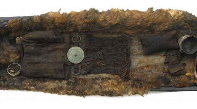
The Surprising and Iconic Bronze Age Egtved Girl: Teenage Remains Tell a Story of Trade and Travel
One of the best-known Danish Bronze Age burials, the well preserved Egtved Girl was found in a barrow in 1921. Her woolen clothing, hair, and nails were perfectly preserved, but all her bones were missing. Scientists studying the ancient teenager’s remains in 2015 made the surprising discovery that the Egtved Girl traveled great distances before her death, and wasn’t from Denmark at all.
A study published in the journal Nature details the results of modern tests done by scientists. Strontium isotope analysis on Egtved Girl’s molar, hair, and fingernails, combined with examination of her distinctive woolen clothing, have revealed she was born and raised hundreds of miles from her burial site in Egtved, in modern Denmark.
Findings show she likely came from The Black Forest of South West Germany, and she traveled between the two locations via ship frequently in the last two years of her life.
The Egtved Girl
According to LiveScience, the Egtved Girl’s oak coffin was uncovered in 1921 from a Bronze Age archaeological site near Egtved, Denmark. The grave was found within a burial mound of dense peat bog, and has been dated to 1370 BC.
The clothing worn by the Bronze Age teenager, Egtved Girl. Credit: National Museum of Denmark
Inside the coffin, the 16 to 18-year-old girl was buried. She is believed to have been of high status. The teenager had been laid on an ox hide and covered by a rough woolen blanket. The contours of where her dead body had lain are still visible, pressed into the ox hide beneath her.
She was of slim build, with mid-length blonde hair, and her clothing—a short string skirt and small, midriff-baring, sleeved top—caused a sensation when revealed in the 20s. Around her waist she had worn a large, spiked bronze disc decorated with spirals. Even now people recreate the stylish Bronze Age fashion .
Other grave goods included bronze pins, a sewing awl, and a hair net. Local flowers decorated the top of the coffin (indicating a summertime burial), as did a small bucket of beer made of honey, wheat, and cowberries.
The Egtved Girl’s coffin during excavations in 1921. Credit: National Museum of Denmark
Another body was found with Egtved Girl in her coffin. Ashes and bones comprised the cremated remains of a small child recovered near Egtved Girl’s head. The identity of the child, who was about five or six years old when he or she died, is not known. No DNA could be recovered from either sets of remains, so their relationship is a mystery.
Well-Preserved Remains
Scientists found that the soil composition of the grave worked as a microclimate, preserving some items and destroying others. Rainwater seeped in to the hollowed-out, oak-trunk coffin, but it was starved of oxygen. These conditions decayed the bones completely away, but left behind excellently-preserved fingernails, hair, scalp, a small part of her brain, and clothing.
Senior researcher Karin Margarita Frei, from the National Museum of Denmark and Centre for Textile Research at the University of Copenhagen analyzed the Bronze Age girl’s remains, according to Science Daily .
Hair and clothing found in the coffin of the Egtved Girl. Credit: Karin Margarita Frei, National Museum of Denmark
Trade and Travel
Analysis of the high-status teenager’s remains, as well as the cremated bones of the young child, showed that the pair had spent much of their lives in a distant land, thought to be Schwarzwald (the Black Forest) in Germany.
“If we consider the last two years of the girl’s life, we can see that, 13 to 15 months before her death, she stayed in a place with a strontium isotope signature very similar to the one that characterizes the area where she was born.
Then she moved to an area that may well have been Jutland. After a period of c. 9 to 10 months there, she went back to the region she originally came from and stayed there for four to six months before she travelled to her final resting place, Egtved. Neither her hair nor her thumb nail contains a strontium isotopic signatures which indicates that she returned to Scandinavia until very shortly before she died.
As an area’s strontium isotopic signature is only detectable in human hair and nails after a month, she must have come to ‘Denmark’ and ‘Egtved’ about a month before she passed away,” Karin Margarita Frei told Science Daily.
The exceptionally-preserved hair of the Egtved Girl. Her burial dates to 1370 BC. Credit: Karin Margarita Frei, National Museum of Denmark
This movement makes sense to researchers. Kristian Kristiansen of the University of Gothenburg told Science Daily, “In Bronze Age Western Europe, Southern Germany and Denmark were the two dominant centers of power, very similar to kingdoms.
We find many direct connections between the two in the archaeological evidence, and my guess is that the Egtved Girl was a Southern German girl who was given in marriage to a man in Jutland so as to forge an alliance between two powerful families.”
The bronze belt disc found on Egtved Girl may have come to the area via the busy trade routes of the day. The spiral decorations are said to be related to a Nordic solar cult, and the bronze is thought to have originated somewhere in the Alps.
Further, the wool that made up her clothing came from sheep outside of Denmark. The ‘fashionable’ Egtved Girl and her mysterious tiny companion have captivated people since their discovery in 1921. Modern research brings the life and death of the prehistoric girl to light in amazing detail, and gives us a better understanding of early European people.
But she is not the only teenage girl found in Denmark that has created a stir in the last few years. In 2017, it was announced that another famous Bronze Age burial of a teenage girl, this time found in Jutland, Denmark was also a traveler from faraway lands. Strontium analysis of the 16- to 18-year-old Skrydstrup woman suggests she originally came from Germany, the Czech Republic, France, or Sweden.
As archaeologist Karin Frei of the National Museum of Denmark told ScienceNordic, “We can’t say with 100 per cent certainty where she [the Skrydstrup woman] came from, and we may never be able to, but she definitely wasn’t Danish.
It gives us so many new perspectives. Now we know that Egtved Girl was not an isolated case.” These studies show that early European mobility was more dynamic that previously believed; Bronze Age people were trading and traveling long distances, quicky.
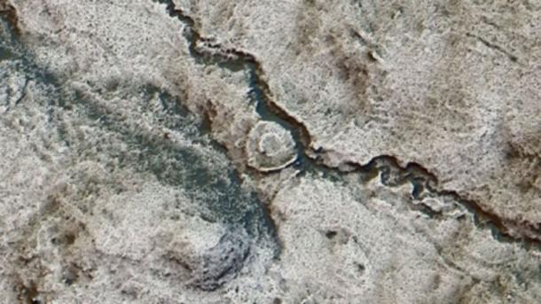
1000 Ancient Sites Revealed by Aerial Scan of Scotland’s Arran Island
Archaeologists in Scotland have concluded a cutting-edge archaeological project which has revealed around 1,000 previously unknown archaeological sites on the Isle of Arran.
There is an island off the coast of Scotland which contains some of northern Europe’s most spectacular standing stones, megalithic tombs, and ruins of ancient farming communities going back around 6,000 years.
I am not talking about Orkney or Shetland but another magical island only a short ferry crossing from Glasgow on Scotland’s west coast, which according to an Island Review article is more famous for its moors and mountains, arts and crafts, beer and whisky, than for its glorious prehistoric archaeology.
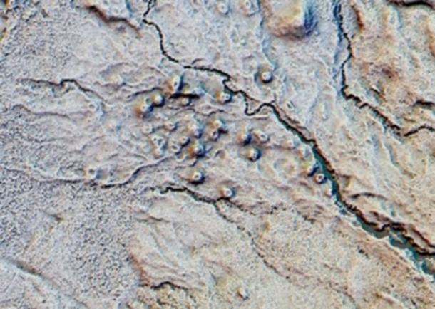
I am of course are speaking about the Isle of Arran in the Firth of Clyde where archaeologists from Historic Environment Scotland (HES) recently flew airborne laser scanning (lidar) devices over the land surface to generate a 3D image of prehistoric settlements, medieval farmsteads, and even a Neolithic monument, which the BBC called an “exceptionally rare find.”
The remains of a hut circle became clear from the LIDAR scanning results.
LIDAR and the Rise Of “Rapid” Archaeology
The lidar data is available from the Scottish Government Remote Sensing Portal and the survey results are available to view on Canmore – Scotland’s National Record of the Historic Environment. It was the largest survey of its type that has ever been conducted.
Dave Cowley, Rapid Archaeological Mapping Manager at Historic Environment Scotland ( HES) said it has shown scientists that there are “double” the number of ancient monuments on the Isle of Arran than they had previously known about and Scottish heritage leaders say “tens of thousands” of further sites might be found using the scanning technology.
Cowley also told reporters that the new 3D technology allowed for a “rapid” archaeological survey conducted over weeks rather than months or years, and it also allowed the discovery of sites that might even have been impossible to find.
Among the structures identified from the air are medieval and post-medieval shielings (circular stone structures which sheltered sheep from winds), which detail how upland areas were used by shepherds.
Post-medieval shielings were identified for the first time with LIDAR.
Furthermore, archaeologists identified a magnificent medieval roundhouse – a type of circular wooden home with a conical roof that was built in Britain from the Bronze Age throughout the Iron Age and into the medieval period .
Mesolithic Pitchstone Traders
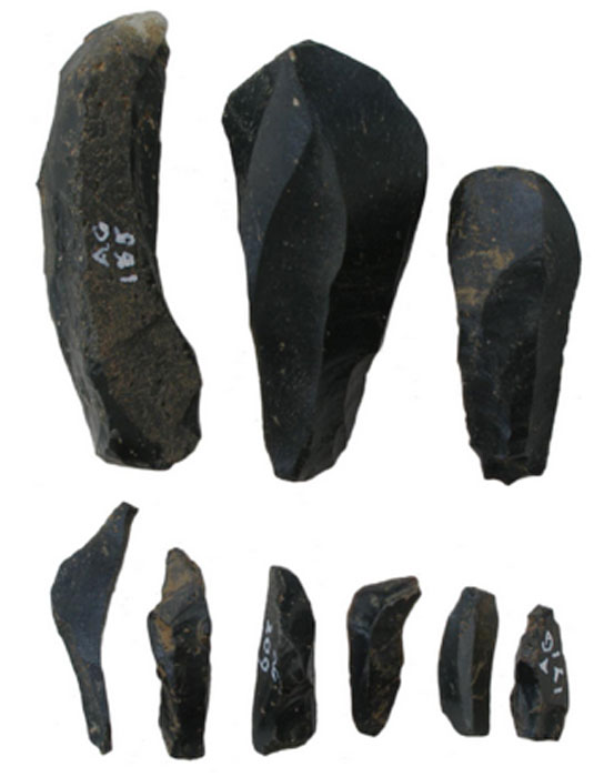
The Isle of Arran is the largest island in the Firth of Clyde and the seventh largest Scottish island . It is often referred to as a “geologist’s paradise,” and as far back as the Neolithic, and the Early Bronze Age, pitchstone from the Isle of Arran were transported around Britain.
According to a study published on Researchgate, worked Arran pitchstone from radiocarbon-dated pits indicate that on the Scottish mainland all archaeological pitchstone derives from outcrops on the Isle of Arran.
And on the island, pitchstone-bearing assemblages include diagnostic types from the Mesolithic that was traded extensively throughout Britain during the Early Neolithic period.
Pitchstone blades and microblades from Auchategan, Argyll & Bute
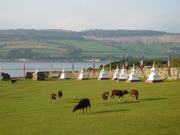
The Isle of Arran – An Ancient Spiritual Center
On Arran, archaeologists find a type of burial structure classified as a ‘Neolithic Clyde Cairn’ which are stone and earth mounds that enclose a chamber lined with larger stone slabs. They are thought to have been used for public community rituals.
Several Bronze Age sites have been excavated and the monastery of Aileach was founded by St. Brendan in the 6th century with the nearby Holy Isle being a center of his spiritual activities. Holy Isle has a long history as a sacred site of pilgrimage with its healing holy well , 6th century monk St Molaise’s hermit cave, and a 13th-century monastery.
ome of the Soay sheep that live wild on Holy Isle in the Firth of Clyde, Scotland, are seen grazing by the Buddhist stupas which line the approach to the Centre for World Peace and Health.
Lidar technology is quickly building a new picture of Scotland’s historic environment and the new study on Arran is another step as the aerial scanning technology becomes more widely available.
And if the scientists’ speculations are right, and “ tens of thousands more ancient sites ” are discovered across the rest of Scotland, a whole new generation of archaeology, and archaeologists, will be attracted to the Highlands of Scotland.
Archaeologists Uncover an Ancient Roman Game Board at Hadrian’s Wall
The cracked stone board was likely used to play ludus latrunculorum, Rome’s favorite game.
Life in the Roman legions is often presented as constant excitement, with endless military campaigns subduing people throughout Europe and the Near East. But the truth is Roman soldiers had down time.
The board was likely used in the bath house at Vindolanda, one of 14 forts along Hadrian’s Wall, but was repurposed as a floor stone in the adjacent building after it was broken.
As evidenced by a gridded gaming board recently uncovered during excavations of Hadrian’s Wall, a 73-mile-long fortification in what’s now northern England that once delineated the northern frontier of the Roman Empire, soldiers played games to pass the time.
Tony Henderson at Chronicle Live reports that the cracked stone game board was uncovered late last month while archaeologists excavated a third century building behind the bath house at Vindolanda, one of 14 forts along Hadrian’s Wall. It’s believed that the board was likely used in the bath house, but was repurposed as a floor stone in the adjacent building after it was broken.
It’s unknown how the board was cracked, but a spokesperson for the site tells Henderson it could be a colorful story. “You can almost picture the losing Roman tipping the board up in frustration, causing it to break,” he says.
This is not the only game board found at Vindolanda. Five other boards dating from the third to fifth centuries have been found along with glass and stone gaming tokens.
Construction of Hadrian’s Wall began in 122 A.D. at Roman emperor Hadrian’s behest and took six years to complete. It was the northernmost border of the Roman Empire until 138 A.D., when the emperor Antoninus Pius abandoned it and built a turf wall about 100 miles to the north.
Twenty years later, the Romans had to fall back to Hadrian’s Wall due to attacks by Caledonian tribes. The forts along Hadrian’s Wall were then occupied by Roman forces until around 400 A.D.
So what were soldiers on the frontier playing to pass the time? The grid on the stone is for a game called ludus latrunculorum, translated from Latin as “the game of mercenaries.” While archaeologists have found game boards and pieces at sites all across the Roman Empire, they have yet to figure out exactly how the game is played.
The website Ancient Games reports that ludus is first mentioned in the second century B.C. by the writer Varro who noted that it was a game played on a grid. A poem by an anonymous writer from the first century A.D. provides some details, including the fact that players captured each other’s pieces, moving backward and forward on the board.
Roman poet Ovid reveals that pieces were captured by surrounding an opposing piece with two game tokens. The game appears to be a more sophisticated variation of checkers, but we can only speculate on the official rules of the game.
That hasn’t prevented some game lovers from trying to develop rules from the little we know, and there are even some commercial versions available.
The game board is not the only recent news from Vindolanda, which has been excavated by the Vindolanda Trust since 1970. In that time, researchers have found thousands of artifacts from legionaries, including rare items made of wood and leather that have survived in the area’s mucky, oxygen-free soil.
Most famously, in 1973, archaeologists dug up hundreds of well-preserved wooden writing tablets that give insight into life at the camp for the average soldier as well as information on how the garrison was administered.
The notes include requests for commanders to send their soldiers more beer, a letter from one entrepreneurial civilian brother to another about making some cash off the soldiers, a birthday invitation and a request for a promotion, among other topics.
Last year, diggers found two sets of rare hipposandals, or iron objects used on the feet of horses, that recently went on display at the site’s Roman Army Museum. It’s not known if they are temporary horseshoes or some sort of restraint. They also found a strange, child-size bronze hand, which was likely part of a cult ritual.
There will undoubtedly be more cool finds, and maybe more game boards. Vindolanda researchers have only excavated about 25 percent of the site. At the current pace, it will take 150 years to unearth the entire area.
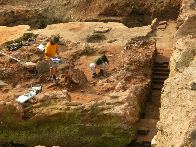
This 3,500-Year-Old Greek Tomb Upended What We Thought We Knew About the Roots of Western Civilization
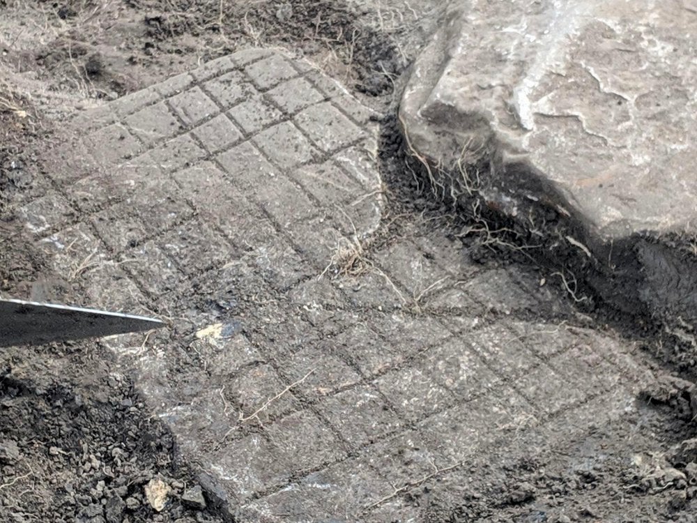
They had been digging for days, shaded from the Greek sun by a square of green tarpaulin slung between olive trees. The archaeologists used picks to break the cream-colored clay, baked as hard as rock, until what began as a cluster of stones just visible in the dirt became four walls in a neat rectangle, sinking down into the earth.
The warrior was buried in an olive grove outside the acropolis of Pylos. Though archaeologist Carl Blegen explored the olive grove in the 1960s, he did not find anything.
Little more than the occasional animal bone, however, came from the soil itself. On the morning of May 28, 2015, the sun gave way to an unseasonable drizzle. The pair digging that day, Flint Dibble and Alison Fields, waited for the rain to clear, then stepped down into their meter-deep hole and got to work. Dibble looked at Fields. “It’s got to be soon,” he said.
The season had not started well. The archaeologists were part of a group of close to three dozen researchers digging near the ancient Palace of Nestor, on a hilltop near Pylos on the southwest coast of Greece. The palace was built in the Bronze Age by the Mycenaeans—the heroes described in Homer’s epic poems—and was first excavated in the 1930s.
The dig’s leaders, Jack Davis and Sharon Stocker, husband-and-wife archaeologists from the University of Cincinnati, in Ohio, had hoped to excavate in a currant field just downslope from the palace, but Greek bureaucracy and a lawyers’ strike kept them from obtaining the necessary permits. So they settled, disappointed, on a neighboring olive grove.
They cleared the land of weeds and snakes and selected a few spots to investigate, including three stones that appeared to form a corner. As the trench around the stones sank deeper, the researchers allowed themselves to grow eager: The shaft’s dimensions, two meters by one meter, suggested a grave, and Mycenaean burials are famous for their breathtakingly rich contents, able to reveal volumes about the culture that produced them.
Still, there was no proof that this structure was even ancient, the archaeologists reminded themselves, and it might simply be a small cellar or shed.
Dibble was clearing earth from around a large stone slab when his pick hit something hard and the monotony of the clay was broken by a vivid flash of green: bronze.
The pair immediately put down their picks, and after placing an excited call to Davis and Stocker they began to carefully sweep up the soil and dust. They knew they were standing atop something substantial, but even then they did not imagine just how rich the discovery would turn out to be.“It was amazing,” says Stocker, a small woman in her 50s with dangling earrings and blue-gray eyes. “People had been walking across this field for three-and-a-half-thousand years.”
Yet remarkably little is known of the beginnings of Mycenaean culture. The Pylos grave, with its wealth of undisturbed burial objects and, at its bottom, a largely intact skeleton, offers a nearly unprecedented window into this time—and what it reveals is calling into question our most basic ideas about the roots of Western civilization.
Jack Davis and Sharon Stocker, husband-and-wife archaeologists from the University of Cincinnati, discovered the warrior’s grave.
In The Iliad, Homer tells of how Agamemnon, king of Mycenae, led a fleet of a thousand ships to besiege the city of Troy. Classical Greeks (and Romans, who traced their heritage to the Trojan hero Aeneas) accepted the stories in The Iliad and The Odyssey as a part of their national histories, but in later centuries scholars insisted that the epic battles fought between the Trojan and Mycenaean kingdoms were nothing more than myth and romantic fantasy. Before the eighth century B.C., archaeologists argued, societies on the Greek mainland were scattered and disorganized.
Today, Blegen’s work at Pylos is continued by Stocker and Davis (his official title is the Carl W. Blegen professor of Greek archaeology). Davis walks with me to the hilltop, and we pause to enjoy the gorgeous view of olive groves and cypress trees rolling down to a jewel-blue sea.
Davis has white-blond hair, freckles and a dry sense of humor, and he is steeped in the history of the place: Alongside Stocker, he has been working in this area for 25 years. As we look out to sea, he points out the island of Sphacteria, where the Athenians beat the Spartans during a fifth-century B.C. battle of the Peloponnesian War.
Behind us, Nestor’s palace is surrounded by flowering oleander trees and is covered with an impressive new metal roof, completed just in time for the site’s reopening to the public in June 2016 after a three-year, multimillion-euro restoration. The roof’s graceful white curves protect the ruins from the elements, while a raised walkway allows visitors to admire the floor plan.
The stone walls of the palace now rise just a meter from the ground, but it was originally a vast two-story complex, built around 1450 B.C., that covered more than 15,000 square feet and was visible for miles. Visitors would have passed through an open courtyard into a large throne room, Davis explains, with a central hearth for offerings and decorated with elaborately painted scenes including lions, griffins and a bard playing a lyre.
The Linear B tablets found by Blegen, deciphered in the 1950s, revealed that the palace was an administrative center that supported more than 50,000 people in an area covering all of modern-day Messenia in western Greece. Davis points out storerooms and pantries in which thousands of unused ceramic wine cups were found, as well as workshops for the production of leather and perfumed oils.
This era, extending until the construction of palaces at Pylos, Mycenae and elsewhere, is known to scholars as the “shaft grave period” (after the graves that Schliemann discovered). Cynthia Shelmerdine, a classicist and renowned scholar of Mycenaean society at the University of Texas at Austin, describes this period as “the moment the door opens.”
It is, she says, “the start of elites coming together to form something beyond just a minor chiefdom, the very beginning of what leads to the palatial civilization only a hundred years later.” From this first awakening, “it really takes a very short time for them to leap into full statehood and become great kings on a par with the Hittite emperor. It was a remarkable thing to happen.”
Yet partly as a result of the building of the palaces themselves, atop the razed mansions of early Mycenaeans, very little is known of the people and culture that gave birth to them. You can’t just tear up the plaster floors to see what’s underneath, Davis explains. The tholos itself went out of use around the time the palace was built. Whoever the first leaders here were, Davis and Stocker had assumed, they were buried in this plundered tomb. Until, less than a hundred yards from the tholos, the researchers found the warrior grave.
Aerial view of the warrior’s grave
The later site of 14th-century B.C. Nestor’s Palace
A bronze sword with a gold-coated hilt was among 1,500 items buried with Pylos’ “griffin warrior.”
Today known as Voidokilia, the omega-shaped cove at “sandy Pylos” is where Homer recounted that Telemachus, Odysseus’ son, was welcomed by Nestor while searching for his father.
Bull sacrifice was practiced by the Mycenaeans at Pylos, as recounted in The Odyssey. The autumn olive harvest is an ancient ritual that survives today.
The tholos tomb at Pylos
Davis and Stocker disagree on where they were when they received Dibble’s call from the dig site. Stocker remembers they were at the team’s workshop. Davis thinks they were at the local museum. Dibble recalls that they were in line at the bank. Whichever it was, they rushed to the site and, Stocker says, “basically never left.”
About a week in, Davis was excavating behind the stone slab. “I’ve found gold,” he said calmly. Stocker thought he was teasing, but he turned around with a golden bead in his palm. It was the first in a flood of small, precious items: beads; a tiny gold birdcage pendant; intricately carved gold rings; and several gold and silver cups.
“Then things changed,” says Stocker. Aware of the high risk of looting, she organized round-the-clock security, and, apart from the Ministry of Culture and the site’s head guard, the archaeologists agreed to tell no one about the more valuable finds. They excavated in pairs, always with one person on watch, ready to cover precious items if someone approached.
The largest ring discovered was made of multiple finely soldered gold sheets.
And yet it was impossible not to feel elated, too. “There were days when 150 beads were coming out—gold, amethyst, carnelian,” says Davis. “There were days when there was one seal stone after another, with beautiful images. It was like, Oh my god, what will come next?!” Beyond the pure thrill of uncovering such exquisite items, the researchers knew that the complex finds represented an unprecedented opportunity to piece together this moment in history, promising insights into everything from religious iconography to local manufacturing techniques.
The discovery of a golden cup, as lovely as the day it was made, proved an emotional moment. “How could you not be moved?” says Stocker. “It’s the passion of looking at a beautiful piece of art or listening to a piece of music. There’s a human element. If you forget that, it becomes an exercise in removing things from the ground.”
Fragments of Ancient Life
From jewelry to gilded weapons, a sampling of the buried artifacts researchers are using to fill in the details about the social currents in Greece at the time the griffin warrior lived
Like any momentous archaeological find, the griffin warrior’s grave has two stories to tell. One is the individual story of this man—who he was, when he lived, what role he played in local events. The other story is broader—what he tells us about the larger world and the crucial shifts in power taking place at that moment in history.
Analyses of the skeleton show that this 30-something dignitary stood around five-and-a-half feet, tall for a man of his time. Combs found in the grave imply that he had long hair. And a recent computerized facial reconstruction based on the warrior’s skull, created by Lynne Schepartz and Tobias Houlton, physical anthropologists at the University of the Witwatersrand in Johannesburg, shows a broad, determined face with close-set eyes and a prominent jaw. Davis and Stocker are also planning DNA tests and isotope analyses that they hope will provide information about his ethnic and geographic origins.
And this has been the scholarly consensus ever since: The Mycenaeans, now thought to have sacked Knossos at around the time they built their mainland palaces and established their language and administrative system on Crete, were the true ancestors of Europe.
Significantly, weapons had been placed on the left side of the warrior’s body while rings and seal stones were on the right, suggesting that they were arranged with intent, not simply thrown in. The representational artwork featured on the rings also had direct connections to actual buried objects.
“One of the gold rings has a goddess standing on top of a mountain with a staff that seems to be crowned by a horned bull’s head,” says Davis. “We found a bull’s head staff in the grave.” Another ring shows a goddess sitting on a throne, looking at herself in the mirror. “We have a mirror.” Davis and Stocker do not believe that all this is a coincidence. “We think that objects were chosen to interact with the iconography of the rings.”
Horns, which symbolize authority, appear on this bronze bull’s head and three gold rings.
In their view, the arrangement of objects in the grave provides the first real evidence that the mainland elite were experts in Minoan ideas and customs, who understood very well the symbolic meaning of the products they acquired. “The grave shows these are not just knuckle-scraping, Neanderthal Mycenaeans who were completely bowled over by the very existence of Minoan culture,” says Bennet. “They know what these objects are.”
“I think we should all care about that,” says Shelmerdine. “It resonates today, when you have factions that want to throw everybody out [of their countries]. I don’t think the Mycenaeans would have gotten anywhere if they hadn’t been able to reach beyond their shores.”