Category Archives: EUROPE

Greek Farmer Accidentally Discovers 3,400-Year-Old Minoan Tomb Hidden Under Olive Grove

Greek Farmer Accidentally Discovers 3,400-Year-Old Minoan Tomb Hidden Under Olive Grove

Sometime between 1400 and 1200 B.C., two Minoan men were laid to rest in an underground enclosure carved out of the soft limestone native to southeast Crete.

Both were entombed within larnakes—intricately embossed clay coffins popular in Bronze Age Minoan society—and surrounded by colorful funerary vases that hinted at their owners’ high status.

Eventually, the burial site was sealed with stone masonry and forgotten, leaving the deceased undisturbed for roughly 3,400 years.

When a farmer was parking his truck under some olive trees on his property when the ground beneath him started to give way. After the farmer moved his vehicle to a safer location, he saw that a four-foot-wide hole had opened up in the ground. When he peered inside, he realized this was no ordinary hole.

The farmer called in archaeologists from the local heritage ministry to investigate, and they began excavating what turned out to be an ancient Minoan tomb, carved into the soft limestone, which had been lying hidden for millennia.

The hole in the ground led to a Minoan Bronze Age tomb.

Two adult Minoan men had been placed in highly-embossed clay coffins called “larnakes” which were common in Bronze Age Minoan culture. These, in turn, were surrounded by funerary vases which suggest that the men were of high status.

The tomb was about 13 feet in length and eight feet deep, divided into three chambers that would have been accessed via a vertical tunnel that was sealed with clay after the tomb’s occupants were laid to rest.

One larnax was found in the northernmost chamber, with a number of funerary vessels scattered around it.

The chamber at the southern end of the tomb held the other larnax coffin, along with 14 amphorae and a bowl. The tomb was estimated to be about 3,400 years old and was preserved in near-perfect conditions, making it a valuable find.

Kristina Killgrove, a bioarchaeologist, wrote for Forbes that the ornamentation on the artifacts found in the tomb suggests that its inhabitants were men of wealth.

The fanciest tombs from the same period, however, had massive domed walls in a “beehive” style, which this tomb doesn’t, so they probably weren’t among the wealthiest.

The find dates from the Late Minoan Period sometimes called the Late Palace Period.

In the earlier part of that era, the Minoan civilization was very rich, with impressive ceramics and art, but by the later part of the period, there is an apparent decline in wealth and prestige, according to Killgrove.

It’s believed that civilization was weakened by a combination of natural disasters, including a tsunami triggered by an earthquake, and the eruption of a nearby volcano. This made it easier for foreigners to come in and destroy the palaces.

The ancient chamber tomb was entirely intact and undamaged by looters.

Locals don’t anticipate the discovery of any more tombs of this type, but the area is known to be the home of a number of antiquities, and a great deal of them have been found by coincidence, as with this find.

The Deputy Mayor of Local Communities, Agrarian, and Tourism of Ierapetra pointed out that the tomb had never been found by thieves, and went on to say that it would probably have remained undiscovered forever, except for the broken irrigation pipe that was responsible for the softened and eroded soil in the farmer’s olive grove.

He went on to say how pleased they were with having the tomb to further enrich their understanding of their ancient culture and history, and that the tomb was proof for those historians who didn’t think that there had been Minoans in that part of Crete.

The skeletal remains were found inside two larnakes (singular: “larnax”) – a type of small closed coffin used in the Minoan and Greek Bronze Age.

Previously, it had been thought that the Minoans only settled in the lowlands and plains of the island, not in the mountains that surround Ierapetra, although there was an excavation in 2012 that uncovered a Minoan mansion in the same area.

Killgrove will be analyzing the skeletons, to see what further information can be gleaned from them. She said, “As a bioarchaeologist, I routinely pore over the skeletons of ancient populations so that I can learn about their health, diet, and lifestyles.” It’s also hoped that analysis can contribute more information to the research on Minoan and Mycenaean origins.

Minoan fresco is commonly known as the ‘Prince of the Lilies.’

Anglo-Saxon Ivory Rings Found in Britain Came from African Elephants

Anglo-Saxon Ivory Rings Found in Britain Came from African Elephants

Unusual rings made from ivory have been unearthed in dozens of early Anglo-Saxon burials in England. The origin of the Anglo-Saxon ivory rings had remained a mystery for 200 years, but scientific testing carried out by a team of researchers from multiple universities in the UK has revealed that the ivory came from African elephants who lived in the fifth and sixth centuries AD.

The researchers, who have just published the results of their study in the Journal of Archaeological Science: Reports , were even able to determine that the elephants lived in East Africa. This means that the ivory was actually sourced nearly 4,000 miles (6,400 km) away from the cemeteries in which the Anglo-Saxon ivory rings were found.

This is an extraordinary distance for ivory to have been transported, given what is known about travel and trade in the first millennium AD. Nevertheless, this remarkable discovery suggests that a trading network must have existed at that time that connected eastern Africa with western Europe, despite the incredible separation in distance.

Anglo-Saxon Ivory Rings of Honor and Status Unearthed in England

Anglo-Saxon ivory rings have been discovered inside excavated graves in approximately 70 cemeteries in central, eastern and southern England. They have been found exclusively in the graves of elite Anglo-Saxon women who lived between the late fifth and early seventh centuries. Archaeologists know these were women of wealth and importance, since their tombs were furnished with elaborate collections of valuable grave goods.

The rings themselves are somewhat enigmatic, as they resemble rings worn on fingers in shape but are much too large to have fulfilled that purpose. This indicates they were not jewelry and must have been used for something else.

The current working hypothesis is that they were bag rings, made to hold open small cloth bags that were worn around the waist. Presumably such bags were worn as a fashion statement, and the use of rings made from valuable ivory to keep them open suggests they were viewed as a luxury item.

Until now, researchers had only been able to speculate about the rings’ origins. They weren’t certain if the ivory used to make them had come from elephants, walruses or mammoths. Before this study, they didn’t know where it had been collected or purchased.

Burial of an Anglo-Saxon female unearthed in Scremby, Lincolnshire. The ivory ring bag was found at her left hip.

Analysis of Anglo-Saxon Ivory Ring Provides Answers

The team of UK researchers performed an extensive analysis of a single bag ring, which was taken from an early Anglo-Saxon burial found in an ancient cemetery near the village of Scremby in Lincolnshire. This cemetery was in use from the late fifth through the early sixth centuries, and the ring was one of seven removed from excavated Anglo-Saxon graves.

To discover which animal the ivory came from, the researchers removed a sample of collagen for chemical analysis. Collagen is the most abundant protein in the bodies of mammals, and it can be found in ivory samples even if they are several centuries old.

Using this methodology, the researchers were able to prove that the ivory came from the tusk of an African elephant. They also performed a radiocarbon dating test on the ring, and this showed that the elephant had lived in the fifth century AD.

With this information in hand, the research team then took measurements of the ivory’s strontium isotope ratios . Strontium is an element absorbed by animals from the surrounding environment, and by measuring its different forms in a biological sample it is possible to tell where an ancient animal lived before it died.

In this case, the strontium measurements showed that the ivory had come from an elephant living in a geological area with a lot of young volcanic rocks. According to Hugh Willmott, this indicates that the elephant lived in the Rift Valley region of East Africa—which is 4,000 miles away from the cemetery where the ivory ring was found.

Anglo-Saxon ivory ring bag and girdle hangers discovered at burial in Scremby.

Tracking the Long-Distance Ivory Trade in the First Millennium AD

Archaeologists unearthed the first bag rings in England more than two centuries ago. Hundreds have been removed from Anglo-Saxon burials over the years, and a few have even been found at gravesites outside the UK, in northwestern Europe.

The rings are large, measuring between four and six inches (10 to 15 cm) in diameter. They have only been found in the graves of wealthy Anglo-Saxon women, often right alongside curious collections of small artifacts. Archaeologists have concluded these items must have been stored in cloth bags attached to the rings, and when the bags decayed into oblivion the items spilled out in mixed piles.

Willmott noted that the objects that were once held in these bags “tend to be quite random. Broken Copper, Roman coins, things like that.” In other words, the bags were the equivalent of purses today, employed to hold items used on a daily basis. Ancient purses attached to ivory rings undoubtedly would have been coveted by Anglo-Saxon women rich enough to afford them.

Because no ivory workshops have ever been found at Anglo-Saxon sites, the researchers believe the ivory would have been carved into rings in Africa before being exchanged or sold as value-added items. Notably, excavations at Eastern African sites linked to the ancient Christian Kingdom of Aksum (modern-day Eritrea and northern Ethiopia) have unearthed significant evidence of ivory working. Meanwhile, historical literature refers to the Aksumites as major dealers of high-quality ivory items from the third through the seventh centuries AD.

On the Anglo-Saxons end, previous excavations have already established that they were importing goods from elsewhere into England during the first millennium. Valued items that Anglo-Saxon elites acquired through trade included amber beads from the Baltic region, cowrie shells from India or the Red Sea region, amethyst beads from the eastern Mediterranean and glass containers from France.

Up to now, what has been missing is solid evidence relating to the specific trade routes that were used to bring these objects to the British Isles. But as this new study makes clear, the geographical range of available trade routes 1,500 years ago must have been quite impressive.

The Anglo-Saxon ivory rings were apparently imported into England for over 100 years. But their use seems to have stopped in the seventh century, possibly because the African ivory trade with Aksum was interrupted following the expansion of Islamic people into North Africa. The newcomers may have seized control of ivory resources in the region, ultimately changing the dynamics of ivory exchange not just in Africa but in the world at large.

Missing Great Pyramid Artifact Found in Scotland

Missing Great Pyramid Artifact Found in Scotland

When British engineer Waynman Dixon came back from a trip to the Queen’s Chamber, deep within the Great Pyramid of Giza, in 1872, he brought with him a piece of wood that was thousands of years old, along with two other items.

Part of a collection of artifacts known as the “Dixon Relics,” two of the artifacts promptly went to the British Museum.

The shard of wood, however, somehow got lost in the vast collection of the University of Aberdeen’s Asia collection, after the daughter of Dixon’s friend, James Grant, donated it in 1946.

It was an absolute fluke that this vital – though small – artifact was found recently by an archaeologist who works at the university as an assistant curator, Abeer Eladany.

She is, in another delightful coincidence, from Egypt originally, and could not believe it when carbon dating tests revealed the age of the wood, which experts speculate predates the construction of the pyramid itself.

No one is sure, precisely, why the wood was put inside the pyramid – was it from a tree that was near by. Or an old tool for measurements– but experts are just as excited about its age as the find itself.

Neil Curtis, head of museums and special collections for the university, told the Guardian, “Finding the missing Dixon Relic was a surprise, but the carbon dating has also been quite a revelation. It is even older than we imagined.” (The other two relics were a ball and a hook).

Tests show that the wood dates between 3341 and 3094 B.C. The pyramid, on the other hand, was built about 500 years prior. One thing is certain, Curtis added: “This discovery will reignite interest in the Dixon Relics, and how they can shed light on the Great Pyramid.”

One person who is particularly thrilled that the relic, lost for more than 100 years, has finally been discovered is Eladany herself, in no small part because she is from Egypt.

As an archaeologist and researcher, she is all too aware of how important the find is to her native country, but she also sees the humour and irony of finding an artifact in Scotland that is, in a sense, a part of the Great Pyramid.

She said that trying to find the lost relic has been like “…looking for a needle in a haystack. I couldn’t believe it when I realized what was inside this innocuous-looking cigar tin.”

Like so many archaeological finds – pieces of human teeth, bits of leather from the sheath of a sword – the find doesn’t look like much to the untrained eye.

The entrance of the pyramid.

In truth, the wood looks much like the remains of a campfire log, or what’s left after a small construction project made of wood. It’s clearly from a piece of wood that was once much bigger.

But to archaeologists, who are the finders – and keepers – of all kinds of knowledge about how human beings developed and evolved – the ancient shard is a breathtaking window into greater wisdom about the pyramid and its contents.

Ancient Archaeological Sites…In America? Dazzling Ruins Not Sole Domain Of Greece & Rome

Ancient Archaeological Sites…In America? Dazzling Ruins Not Sole Domain Of Greece & Rome

We tend to think of the United States as the home of all things bright, shiny and new, not a land of ancient cultures and archaeological sites that fascinate history buffs and experts alike.

That’s what happens when one operates on assumptions and misinformation, instead of truths and cold, hard facts – we end up with metaphorical egg on our faces.

In fact, there are several places in America that rival some of the most important archaeological sites in Greece and Rome. Sites that are truly ancient.

Sites that date back thousands of years. Sites that continue to offer insights and valuable information to the folks who study America’s geographic development, as well as the country’s Native populations who lived there long before Columbus crossed the Atlantic from Europe.

MESA VERDE, CO – JULY 12: Visitors tour the dwellings at Cliff Palace in Mesa Verde National Park.

Here’s a quick look at six of the most compelling sites in the U.S., and each one of them offers a unique glimpse into the past for anyone anxious to venture there to hike and stroll along the many winding paths that comprise these territories.

Once travel in the U.S. is unrestricted again, after the coronavirus has passed into our collective history and we feel safe leaving home once more, these spots should be on any travellers’ “most wanted” destinations.

1) Mesa Verde National Park, Colorado: This is probably the most famous of the ancient ruins scattered across America, a series of cliff dwellings established by the Puebloans who were simply trying to stay alive in the extreme climate of the desert.

A view of Balcony House, one of the cliff dwellings built by the Ancestral Puebloans at Mesa Verde National Park, Colorado, taken on May 14, 2015.

The area dates back from 900 to 1200 A.D., and the sandstone structures can be toured, hiked and even camped in by hardy folks willing to brave the desert climes and see how ancient peoples lived. The site is huge, and deserves at least two days of touring to see all on offer in this amazing place.

2) Chaco Culture National Park, New Mexico: Built between 900 and 1100 A.D., this area once belonged to a thriving mining community that extracted turquoise from the San Juan Basin.

The buildings here were the biggest anywhere in North America until the 19th century, and today’s modern Hopi Indians consider this their true ancestral home. Most areas are open for free touring.

3) Serpent Mounds & Earth Works, Ohio: These structures are in fact ancient burial grounds, each one sculpted in a unique shape called an earth work. Some date back 10,000 years, but today some experts believe these sculptures in fact date back even further, and may have been built around 321 B.C.

The spiral tail at the end of the Serpent Mound.

4) Mule Canyon, Utah: This area has a system of ruins on a trail in southeast Utah, a four-mile hike along which are some of America’s most dazzling ancient sites.

Although some climbing is involved at various spots along the trail, the hiker is ultimately rewarded with an amazing natural spring at the end, the perfect place to relax, splash on some cold water and stretch out. There are eight sites in total along this famous trail.

Hikers look around the House on Fire Indian ruins in Mule Canyon, which is part of the Bears Ears National Monument on June 14, 2019 outside Blanding, Utah.

5) Wupatki Natural Monument, Arizona: When a volcano erupted thousands of years ago, in the 12th century, this region’s Native population expanded outward from Flagstaff into the desert.

There are five structures here open to the public, one of which has more than 300 rooms. They’re open for exploring, free to anyone adventurous enough to climb some of the nooks and crannies in each of the ancient ruins.

Couple walks through ancient Wupatki Pueblo Indian ruins in Wupatki National Monument Arizona.

6) Cahokia Mounds Historic Site, Illinois: This was once a thriving economic area that held about 40,000 people, according to archaeologists and other experts.

It was home to the Mississippian culture, which was at its apex in the 13the century. Bodies have been found here among the ruins, indicating it was a burial site as well as a busy metropolis.

5,000-Year-Old Wooden Stakes Discovered at Neolithic Site in Scotland

5,000-Year-Old Wooden Stakes Discovered at Neolithic Site in Scotland

Archaeologists at the Ness of Brodgar ceremonial center in Scotland have discovered two pieces of wood dated to the Neolithic era, reports Craig Munro for the Press and Journal.

Researchers successfully recovered one of the two prehistoric timbers.

Found in two postholes in the floor of a structure at the Orkney site, the prehistoric wooden stakes survived for 5,000 years due to a dip in the floor, which may have funneled moisture into the holes and helped preserve the material.

“The wood is not in good condition, which is hardly surprising after thousands of years in the ground,” says the excavation team in a statement.

Initially, the researchers suspected the wood was too mushy to be lifted out. On August 3, however, archaeologist Jo McKenzie managed to successfully recover one of the stakes. (McKenzie documented the process in a “dig diary” video posted online.)

Next, the team hopes to identify the type of wood present and determine if the wooden stakes were sharpened before being driven into the holes.

“[T]he smaller of the two stakes had a beautifully square base and rested on a flat stone at the bottom of the post-hole, which presumably acted as a cushion,” note the researchers in a separate statement.

The Ness of Brodgar is part of the Heart of Neolithic Orkney Unesco World Heritage site. Since 2006, excavations at the site have unearthed a large sandstone building complex, pottery, bones, artwork and stone tools.

As the Guardian’s Kevin McKenna reported in 2016, the site’s builders carried its materials from different parts of the island, sometimes over several miles. This suggests that people from across the area may have used the buildings as meeting places for trade and ceremonial activities.

“I think we had always tended to depict our Neolithic ancestors as Stone Age hippies who frolicked around large stones in some herb-induced fugue,” the site’s director, Nick Card, told the Guardian. “But this settlement depicts a dynamic, skilled and creative people whose workmanship would bear scrutiny with 21st-century methods.”

In addition to the Ness of Brodgar, the World Heritage Site encompasses two stone monuments, the Ring of Brodgar and the Stones of Stenness; a burial site known as Maeshowe; and a settlement called Skara Brae. The area is known for its Grooved Ware pottery.

This ceramic style, featuring a flat bottom and intricate decoration, has been found in many parts of Britain and Ireland, but the earliest known examples are from Orkney.

The wood is in poor condition but could still hold valuable information for researchers.

Per Orkneyjar, researchers think the invention of Grooved Ware, along with some of the building innovations at Orkney, may have reflected the emergence of an elite group within the Neolithic society. The large amounts of labor that went into the complicated creations appear to have benefitted some people more than others.

The new find took place in the oldest part of the Ness, which dates to around 3100 B.C., according to the Press and Journal. The structure where the wood was discovered is near the complex’s eastern entrance. Archaeologists say it may be a particularly important part of the site because it features external upright slabs called orthostats.

Excavations at Ness Brodgar have been slowed by the Covid-19 pandemic, which prevented work in 2020 and allowed only a limited number of researchers to be on site during the current season.

As BBC News reports, volunteers are helping to cover the site with tarps held down by tires, as they do each year. This technique protects the site from severe weather in the fall and winter.

“The tires serve two purposes—they hold down the protective covers that envelope each trench and offer a degree of support for more fragile areas,” Sigurd Towrie of the Archaeology Institute of the Highland and Islands tells BBC News.

“The site has to be covered over for its protection. Much of the stone used in the construction of the buildings back in the Neolithic laminates when exposed to the elements for any length of time.”

French Archaeologists Make ‘Unprecedented Discovery’ of What May Be the Remains of a Roman-Era Mausoleum

French Archaeologists Make ‘Unprecedented Discovery’ of What May Be the Remains of a Roman-Era Mausoleum

The apparent funerary monument was unearthed in Néris-les-Bains, a Roman colony in the 1st century C.E.

In what archaeologists are hailing “an unprecedented discovery” for the region, the remains of a set of Gallo-Roman buildings—including what might be a funerary monument—have been excavated in a residential district in Néris-les-Bains, a town in Auvergne, France.

General view of the excavation site.

Undertaken by a team from the French National Institute of Preventive Archaeological Research (INRAP), the dig located the remnants of a group of structures delimited by a road.

They include two buildings with a partially legible plan, two others represented by walls with tiles bound in lime mortar, and a pipe network. The northwestern segment of the plot houses a large pit. 

It was close to this pit that archaeologists uncovered a number of relics that have helped date the site to the Gallo-Roman period from the 1st to 5th century.

The archaeologists clearing relics at the Néris-les-Bains site.

They include a fragment of a modillion, an elaborate cornice that would have decorated the top structure of buildings, and a pilaster, a rectangular column carved with interlocking leaves and topped by a figurine.

A conical architectural element measuring some 55 inches in diameter was also found, its surface carved with scales and its back holding an anathyrosis frame, indicating it was meant to be joined to a similar piece as part of a circular spire. 

More notable is the discovery of 21 sandstone blocks—“a big surprise,” Marie-Laure Thierry, head of the operation at INRAP, told La Montagne. Once cleaned with water and a sponge, archaeologists found they were adorned with bas-reliefs that “have an unprecedented character for Néris-les-Bains, even for Auvergne,” added Thierry.

The most “representative” relief, according to the team, is a frieze fragment, measuring about 27 by seven inches, which portrays Triton, Greek god of the sea, with his arms spread, hair long, and tentacles ending in palm leaves. He is flanked on his right by a horse (or more probably, a seahorse), with only its two front legs visible. 

The sandstone blocks showing bas-reliefs of a possible mausoleum at the archaeological center of Clermont-Ferrand.

The combination of the frieze, the conical spire (with scales recalling the sea god), and the ornate cornice have led researchers to associate the finds with mausoleums that were constructed in the 1st and 2nd centuries.

The motif depicting a figure from Greek and Roman mythology, in particular, symbolizes the journey of blessed individuals into the afterlife. “It was certainly not the tomb of ordinary mortals,” said Thierry of the monument. 

Other comparable funerary structures have been identified in Auvergne, from Aulnat to Mont-Dore, where similar artifacts representing Triton were found.

The INRAP team plans to carry out detailed studies of the architectural blocks to support its early hypothesis and further illuminate the history of Néris-les-Bains.

The town, best known for its thermal baths (its name derives from Nérios, Gallic god of the spring), was colonized by Rome in the early centuries—a period borne out by the number of Roman and Gallic ruins and relics, including an amphitheater, that have been excavated in the area since the 19th century. 

According to INRAP, the recent discovery of the settlement and its artifacts could well open “a new window on the occupation of this peripheral and little-known sector of the ancient agglomeration of Néris-les-Bains.”

Archaeologists Discover They’ve Been Excavating Lost Assyrian City

Archaeologists Discover They’ve Been Excavating Lost Assyrian City

Cuneiform tablets revealed the site in Iraqi Kurdistan is the legendary city of Mardaman.

In 2013, archaeologists from the University of Tübingen in Germany began excavations on an ancient Assyrian city in the Kurdistan region of modern-day Iraq. While they were able to establish the city dated back as early as 2800 to 2650 B.C.E., they weren’t sure exactly what city it was that they were excavating, according  .

That is until last summer. While digging in a site that was once a palace, they unearthed 92 cuneiform tablets hidden in a piece of pottery that revealed where, exactly, they were working: the lost city of Mardaman.

According to a press release, the city was once an important commercial hub that’s been cited in many writings. Over the course of its 1,000-year history, Mardaman was captured, destroyed and rebuilt several times.

Notably, during that time span, its position on trading routes between Mesopotamia, Anatolia and Syria made it a desirable slice of geography. It served for a time as a capital of a Mesopotamian province and at one point was its own independent kingdom.

The crumbling tablets were deciphered by Betina Faist of the University of Heidelberg, who is a specialist of the Assyrian language. Using photographs of the texts, she found that they date from the Middle Assyrian Empire and reveal that Mardaman was the administrative seat of a previously unknown Assyrian province.

The texts appear to be documents from a governor of the province named Assur-nasir, and they describe some of his daily activities.

The find adds a coda to the long story of Mardaman. By the time it appears in the historical record around 2250 B.C.E. it was already established and was leveled by Naram-Sin, who ruled the Akkadian Empire, the first multi-national empire in known history.

Between 2000 and 2100 B.C. it was an important trade center on the edge of Mesopotamia and the center of its own kingdom, which was conquered in 1786 B.C.E. by Shamshi-Adad I, who acquired much of the ancient Near East, creating the Upper Mesopotamian Empire and proclaiming himself “King of All.”

After that, Mardaman regained its independence and became a prosperous independent kingdom again. But the good times didn’t last; the Turukkaean people from the nearby Zagros Mountains flattened the city. There Mardaman disappeared from recorded history until the new writings were discovered.

“The cuneiform texts and our findings from the excavations in Bassetki now make it clear that that was not the end,” Peter Pfälzner of the University of Tübingen, who is heading the excavations, says in the press release. “The city existed continuously and achieved a final significance as a Middle Assyrian governor’s seat between 1,250 and 1,200 B.C.E.”

Pfälzner explains that the tablets may have been a sort of message in a bottle. They were found in the earthenware vessel covered in a thick layer of clay.

“They may have been hidden this way shortly after the surrounding building had been destroyed. Perhaps the information inside it was meant to be protected and preserved for posterity.”

Mardaman is not the only lost city in Iraq. Last month, officials revealed that looted artifacts purchased by Hobby Lobby likely came from a lost Sumerian City in the country called Irisagrig.

Last year, researchers also revealed that they are using quantitative​ analysis to find the locations of 11 lost Assyrian cities by analyzing 12,000 cuneiform tablets from traders, who moved merchandise between those cities and other known cities in the Bronze Age.

Did Vikings Host Rituals Designed to Stop Ragnarök in This Volcanic Cave?

Did Vikings Host Rituals Designed to Stop Ragnarök in This Volcanic Cave?

New findings at a cavern in Iceland point to decades of elite ceremonial activity aimed at preventing the apocalypse.

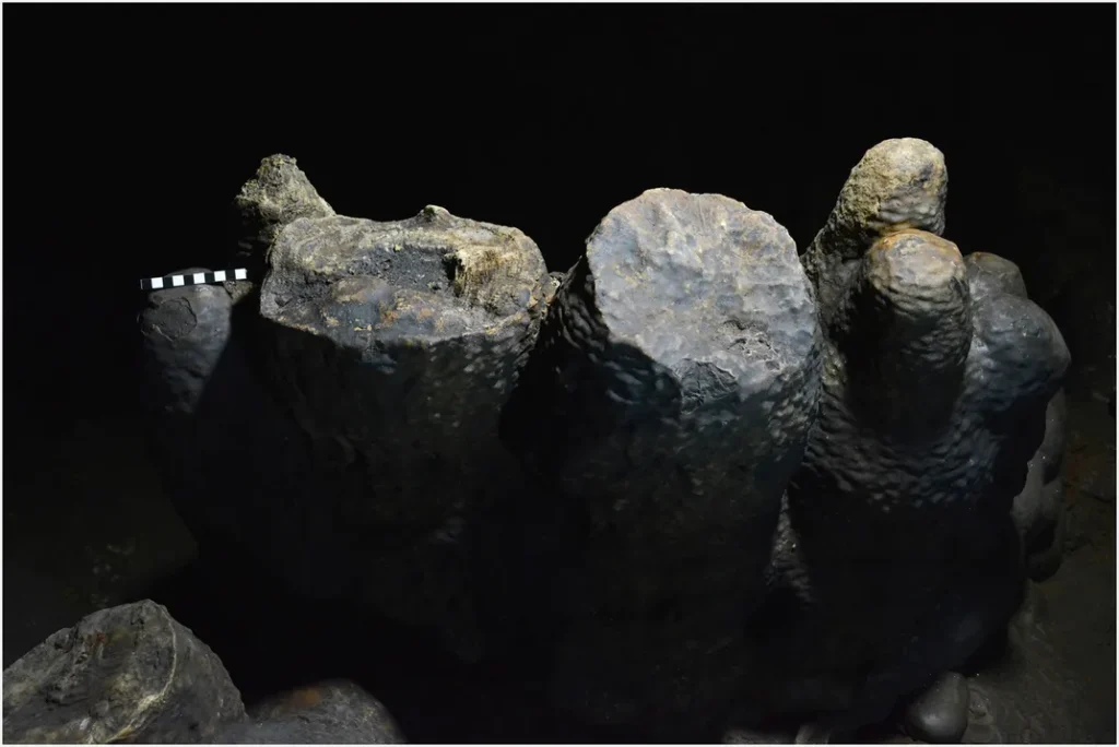
Some 1,000 years ago, Viking elites may have hosted ceremonies intended to avert the apocalypse at a large ritual site deep in a volcanic cave in Iceland.

Elite Vikings constructed a huge stone boat for use in rituals at the Surtshellir cave.

As the Jerusalem Post reports, archaeologists investigating the site, located about 980 feet beyond the cave’s entrance, discovered a boat-shaped rock structure, as well as beads and decorative materials from distant lands.

The team’s findings, published in the Journal of Archaeological Science, show that the eruption that formed the cave, known as Surtshellir, occurred in the late ninth century A.D., soon after the first Viking settlement of Iceland.

Per the paper, this incident was probably the first major volcanic eruption witnessed by people in northern Europe since the end of the last Ice Age more than 10,000 years prior. The explosion covered about 90 square miles of fertile land in volcanic rock.

“[T]he impacts of this eruption must have been unsettling, posing existential challenges for Iceland’s newly arrived settlers,” write the authors in the study.

According to Owen Jarus of Live Science, the Vikings entered the newly formed cave soon after the lava cooled. They constructed the boat structure, placing ritual offerings inside and burning the bones of animals, including sheep, goats, cattle, horses and pigs.

Historical records show that the Vikings associated the cave with Surtr, a giant responsible for battling the gods during Ragnarök and bringing about the end of the world in Norse mythology.

“Our analyses indicate that these activities continued, perhaps as annual sacrificial rituals, for at least 60 [to] 80 years until Iceland converted to Christianity,” says lead author Kevin P. Smith, deputy director of the Haffenreffer Museum of Anthropology at Brown University, in a statement. “And the objects left behind in the cave imply that they were conducted by members of Iceland’s elite.”

Live Science notes that participants in the ritual may have believed that the precious goods would appease Surtr, or that they could strengthen Freyr, the fertility god said to fights Surtr during Ragnarök. (As James Deutsch, a curator at the Smithsonian Center for Folklife and Cultural Heritage, wrote for Smithsonian magazine in 2017, this “apocalyptic battle” is, in popular lore, followed by the second coming of a new generation of gods.)

The Surtshellir cave is named after a giant from Norse mythology.

Among the artifacts found in the cave was orpiment, a pigment from eastern Turkey used for decorative purposes, and 63 beads, some of which came from as far away as Baghdad.

These goods may have arrived in Iceland via trade routes. Per Rym Ghazal of the National, previous research has documented extensive ties between Vikings and the Islamic world. Islamic coins and other objects have been found in many Viking graves.

Scandinavians in the early Viking age were almost all pagans, but their polytheistic system allowed them to accept the Christian God alongside others, according to Gareth Williams of BBC History.

Many Vikings who settled in Christian lands such as Normandy and Ireland converted to Christianity. Those in Scandinavia widely adopted the religion between the 11th and 12th centuries.

The new research shows that conversion to Christianity seems to have led to the abandonment of rituals at the cave. One of the last artifacts placed in the rock boat was a set of scale weights, including one in the form of a Christian cross, which may have been intended as a signal of the end of pagan rituals at the site.

Still, some of the mythology around the cave appears to have persisted, with an Icelandic Christian tradition identifying Surtshellir as the place where Satan would emerge on Judgment Day, notes the study.

As Samir S. Patel reported for Archaeology magazine in 2017, Surtshellir is one of the largest volcanic caves in Iceland, with tunnels measuring up to 40 feet in diameter.

It contains a number of artificial features, including a 15-foot wall made up of blocks weighing up to four tons. Icelandic sagas and folk stories suggest that the cave may have been a hideout for outlaws at various times, though research by Smith and his colleagues found few signs that anyone actually lived there.

The researchers have created a Facebook page where they share updates on their work and related subjects.

Moroccan Cave Find Shows Ancient Humans Made Clothes 120,000 Years Ago

Moroccan Cave Find Shows Ancient Humans Made Clothes 120,000 Years Ago

Researchers have announced the discovery of bone tools in a cave in Morocco that appear to have been used to carefully remove skins and fur from the bodies of dead animals. The skins recovered this way were apparently used to make clothing.

Such a find would not normally be considered remarkable. But these particular tools are approximately 120,000 years old, which pushes the timeframe for clothes-making practices farther back into the past than scientists would have once believed was possible. 

“These bone tools have shaping and use marks that indicate they were used for scraping hides to make leather and for scraping pelts to make fur,” anthropologist and research team leader Dr. Emily Hallett explained in a press release from science journal publisher Cell Press .

“At the same time, I found a pattern of cut marks on the carnivore bones from Contrebandiers Cave that suggested that humans were not processing carnivores for meat but were instead skinning them for their fur.”

The ancient fur and leather makers were early Homo Sapiens (modern humans), who at this point had yet to leave Africa to explore and colonize the rest of the planet. Even before the original great migration that scattered their populations across the globe, the earliest humans were showing a surprisingly sophisticated range of behaviors.

“Our study adds another piece to the long list of hallmark human behaviors that begin to appear in the archaeological record of Africa around 100,000 years ago,” stated Dr. Hallett, who along with most of the scientists involved in this research project is affiliated with the Max Planck Institute for the Science of Human History in Germany.

The Contrabandiers Cave site, Morocco

Researchers don’t expect to find actual clothing samples during excavations at Contrebandiers Cave. Leather and fur clothing would be too delicate to be preserved for more than 100,000 years.

But fascinating studies of the DNA of clothing lice have shown that they likely evolved from human head lice somewhere between 83,000 and 170,000 years ago. This takes their origin back to the time when modern humans were still living exclusively Africa, offering further evidence that people have been making clothes for a very long time.

The Tools Tell the Tale

As they explain in an article detailing their discoveries in the journal iScience, Dr. Hallett and her colleagues closely examined the remains of animal bones excavated over several decades from Contrebandiers Cave on Morocco’s Atlantic coast. These bones had been unearthed in layers dating back to between 120,000 and 90,000 BC, and had been found alongside the skeletal remains of humans who were using the cave throughout that time period. 

Some of the animal bones (62 to be exact) had clearly been fashioned into tools of various kinds, and one type of tool in particular caught their attention. These sturdy objects were made from the rib bones of cattle, and had been rounded into the shape of a spatula on one end. 

“Spatulate-shaped tools are ideal for scraping and thus removing internal connective tissues from leathers and pelts during the hide or fur-working process, as they do not pierce the skin or pelt,” the researchers wrote in their iScience article.

Skinned fox bones with evidence of scraping

A few of the bones Dr. Hallett and her colleagues looked at hadn’t been made into tools at all. But they contained telltale scraping marks showing that attached skin and fur had been thoroughly and carefully removed. It is notable that the bones that contained such markings came from species that likely would have possessed thick coats of fur, including ancient versions of foxes, wildcats, and jackals. 

Dr. Hallett found other marked bones that came from species similar to modern cattle. But in these cases, the cuts and scrapings had different characteristics. These marks were of a type that would be caused if meat were being deboned, in preparation for it to be used as food.

One other intriguing discovery found at the cave was a whale’s tooth , which had been partially modified and was likely used to flake stone. Dating to the same 120,000 to 90,000 BC period, this is the oldest tool made from marine mammal bone that has ever been found during an archaeological excavation, anywhere in the world. Nothing of its kind from any time period had ever been found in northern Africa before, Dr. Hallett confirmed.

Prehistoric Humans Were Doing It, and Neanderthals Were Doing It, Too

Dr. Hallett doesn’t think modern humans were the only hominin species to discover the benefits of clothes-making.  She believes that European Neanderthals were making clothing from animal skins and furs before modern humans arrived in the region, most likely approximately 40,000 years ago . 

Evidence is available that supports this theory. In 2013, archaeologists discovered a particular type of leatherworking tool known as a lissoir during excavations at two caves (Abri Peyrony and Pech-de-l’Azé) in southwestern France. These caves were once occupied by Neanderthals rather than humans, and that the tools in question had apparently been manufactured around 50,000 BC.

Commenting on the latest findings in Morocco, Dr. Matt Pope, an archaeologist from University College London, told the Guardian that these ancient humans must have been accomplished leatherworkers.

“This is an adaptation which goes beyond just the adoption of clothing,” he said. “It allows us to imagine clothing which is more waterproof, closer-fitting and easier to move in, than more simple scraped hides.” 

How the tools were fashioned and used

Dr. Pope noted that well-processed leather could have also been used to make containers, windbreaks, shelters, and many other useful products. Since Neanderthals were using similar sophisticated tools in Europe, he theorized, they must have been quite skilled at making leather products of various types as well.

Dr. Hallett is curious to see if other archaeologists exploring human-occupied caves elsewhere in Africa will find similar evidence of ancient clothes-making practices. Now that they know such evidence exists, they will know what to look for and won’t dismiss findings that push the clothes-making timeline back even deeper into prehistory.

‘Lost’ 2nd-century Roman fort discovered in Scotland

‘Lost’ 2nd-century Roman fort discovered in Scotland

Archaeologists have discovered the buried remains of a Roman fort along Scotland’s ancient Antonine Wall.

Archaeologists have discovered the foundations of a “lost” second-century Roman fort in western Scotland — part of an ill-fated effort to extend the empire’s control throughout Britain.

The remains of the newfound small Roman fort are now underground. But it was one of about 41 defensive structures along the Antonine Wall, which stretched across Scotland for 40 miles. The defenses included 16 larger forts.

The fort was one of up to 41 defensive structures built along the Antonine Wall — a fortification of mainly earthworks and wood that ran for about 40 miles (65 kilometers) across Scotland at its narrowest point, according to Historic Environment Scotland (HES), a government agency.

The Roman emperor Antoninus Pius ordered the wall built in A.D. 142 in hopes of surpassing his predecessor Hadrian, who about 20 years earlier had built the fortification known as Hadrian’s Wall about 100 miles (160 km) to the south.

But his push was ultimately unsuccessful, in part because of the hostility of the Indigenous people. (At this time the Romans called them “Caledonians”; later they would call them “Picts,” from a Latin word meaning “painted people,” because of their body paintings or tattoos.) After 20 years trying to hold their new northern line, the Romans abandoned the Antonine Wall in A.D. 162 and retreated back to Hadrian’s Wall. 

Archaeologists detected the fort’s buried stone foundations with a non-invasive geophysical technique called gradiometry, which measures tiny variations in the Earth’s magnetic field.

“Antoninus Pius was effectively a bureaucrat,” historian and archaeologist John Reid told Live Science. “He had no military experience, and we think he was looking for a win that he could pretty much guarantee against the exotic Caledonian people.”

Reid explained that Roman emperors needed to claim a military victory, and so Antoninus Pius used his conquest of Scotland — while it lasted — to justify his rule.

Reid, who was not involved in the new discovery, is author of the book “The Eagle and the Bear: A New History of Roman Scotland” (Birlinn, 2023) and chairman of the Trimontium Trust, which investigates Roman archaeology in the Scottish Borders region.

“Lost” fort

Archaeologists from HES found the buried remains of the small fort, or “fortlet,” beside a school on the northwestern outskirts of the modern city of Glasgow.

The structure was mentioned by an antiquarian in 1707, but it had never been found since, despite efforts to locate it in the 1970s and 1980s.

The fort consisted of two small wooden buildings surrounded by a rampart of stone and turf up to 6.5 feet (2 meters) high, built along the south side of the Antonine Wall. The rampart had two wooden towers above gates on opposite sides — one at the north to let people, animals and wagons through the wall and one at the south.

None of the Roman forts along the Antonine Wall are now visible, although excavations have revealed evidence and its defensive ditch can still be seen in some places.

But there’s now nothing above ground to show that the fort was ever there; , and the archaeologists located its buried stone foundations using gradiometry, a noninvasive geophysical technique that measures tiny variations in Earth’s magnetic field to detect underground structures. 

About 12 soldiers — many of them local auxiliaries, or “auxilia,” who had signed on to fight for the Romans — would have been stationed at the fort for about a week at a time to keep watch over the area and prevent raids on the fortifications.

They’d then be relieved by a new detachment of soldiers from a larger Roman fort at Duntocher, about a mile (1.6 km) to the east, according to the HES statement.

Roman wall

The fort is mentioned in writings from 1707, but it hadn’t been seen since. No sign of it now remains above the ground.

There’s now little visible evidence of the Antonine Wall, and the newly discovered fortlet is a rare find.

Reid said it helped confirm a theory that the Romans first hoped to duplicate Hadrian’s Wall, with stronger and higher fortifications made of stone and a small fort, or “milecastle,” every mile of its length. “But then they thought better of it and decided they needed proper-sized forts,” he said. 

Roman fortifications in the Tayside region, north of the Antonine Wall, showed that the Romans planned to subjugate all of Scotland, but the Antonine Wall and any northern possessions seem to have been abandoned after A.D. 162, he said. 

Thereafter, Hadrian’s Wall became the northernmost frontier of the empire, seemingly until Roman rule collapsed in Britain in the early fifth century, he said.

Reid’s Trimontium Trust has conducted excavations at Burnswark Hill, the site of a Caledonian hillfort and a fortified Roman military camp built to attack it after Antoninus Pius ordered his legions to conquer Scotland north of Hadrian’s Wall. Among the finds there were whistling sling bullets that the Romans may have used as “terror weapons” against the defenders.

The reason for the Roman eventual withdrawal from the Antonine Wall and back to Hadrian’s Wall is not well understood. 

“There’s lots of debate,” Reid said. “Was it because the Romans got fed up? Was it because the Romans had trouble elsewhere? Was it because it was too costly to run two frontiers? Was it because Antonius Pius died [in A.D. 161]? Nobody’s really sure; I suspect it was a combination of all of those.”