Category Archives: EUROPE

The Mysterious Underwater Land Mass Known as the ‘British Atlantis’

The Mysterious Underwater Land Mass Known as the ‘British Atlantis’

The area known as Doggerland is a real-life Atlantis from a time when the British Isles were neither British nor Isles.

The land occupied a great portion of where the waters of the North Sea extend nowadays.

After the last major Ice Age, some 12,000 years ago, the area got flooded over time by the rising sea levels.

Map showing hypothetical extent of Doggerland (c. 10,000 BC), which provided a land bridge between Great Britain and continental Europe.

Just like London mudlarks retrieve all sorts of memorabilia and historical items from the Thames riverbed, fishermen in the North Sea have reported findings including ancient bones, artifacts, and 9,000-year-old tools.

Dutch and British archaeologists and paleontologists were immediately interested by the discoveries as they were evidence for the existence of Doggerland.

This could be a leftover from Doggerland.

Named after the Dogger Bank, Doggerland was first mentioned in a book A Story of the Stone Age by H.G. Wells, written in the late 19th century. The book suggested the existence of a prehistoric region that fused Britain’s east coast with the European mainland.

Archaeologists at the University of Bradford are working on a huge project to reconstruct the ancient Doggerland landscape which is now underneath the sea.

They are aiming to produce a 3D chart of the landscape with the help of seabed mapping data gathered by energy companies.

The red line marks Dogger Bank, which is most likely a moraine formed in the Pleistocene.

In the meantime, scientists wait on core sediment samples to extract DNA fragments from plants and animals, so that we can learn more about the flora and fauna that once existed.

Before the last glacial period, the vast piece of land that connected Europe and Britain consisted of a diverse mix of gentle hills, swampland, and dense forests.

With the lessening of the huge weight of ice, melting water got locked away which caused the land to tilt in an isostatic adjustment.

Early Holocene landscape features mapped by the North Sea Palaeolandscapes Project.

The ancient region was inhabited by thousands of Mesolithic Stone Age settlers. It was also a very important land bridge between Europe and Britain.

According to the evidence gathered, scientists believe that the Doggerlanders were nomadic hunter-gatherers who migrated with the season. They lived on hunting, fishing, and gathering foods such as berries, nuts, and mushrooms.

Map of Doggerbank, 1867.

For hundreds of years, fishermen have pulled up all kinds of finds in their nets in the area off the coast of Dogger Bank.

In 1931, there was a famous discovery of a lump of peat which contained an ornate barbed antler point used for harpooning fish. It was hauled up near the Ower Bank, 25 miles off the English coast.

Woolly mammoth skull discovered by fishermen in the North Sea, at the Celtic and Prehistoric Museum, Ireland.

It is most likely that Doggerland was habitable until 10,000 BC and that the last remaining island was flooded in a single gigantic event some 8,000 years ago.

There was an enormous landslide off the coast of Norway, the Storegga Slide, in which an estimated 180-mile length of the coastal shelf crashed in the Norwegian Sea. That triggered a tsunami in the North Atlantic Ocean with waves up to 17 feet in height.

Map showing hypothetical extent of Doggerland from Weichselian glaciation until the current situation.

“The only populated lands on earth that have not yet been explored in any depth are those which have been lost underneath the sea,” says Professor Vince Gaffney, Anniversary Chair in Landscape Archaeology at the University of Bradford.

The study of this long-forgotten, sunken Stone Age habitat is important so that we can learn about the ultimate outcomes of potentially rising sea levels.

Experts who study and research Doggerland are attempting to connect the events that caused the disappearance of the land with present day possibilities.

10,000-Year-Old Crayon Found in Ancient Lake Was Used to Decorate Animal Skins

10,000-Year-Old Crayon Found in Ancient Lake Was Used to Decorate Animal Skins

Archaeologists have reportedly discovered a prehistoric, ochre crayon believed to have been used to draw on animal skins 10,000 years ago. The crayon was discovered near the site of an ancient lake in North Yorkshire, England.

Earliest Example of Crayon Discovered?

The area where the crayon was found is near one of the most famous Mesolithic sites in Europe, Star Carr. As the experts suggest, this could be a very important and historic discovery, as it may be the earliest example of a crayon ever found.

The crayon is made of a red mineral pigment called ochre and was unearthed near an ancient lake now covered in peat, near Scarborough, North Yorkshire as BBC News reported .

Archaeologists speculate that the crayon could have possibly been used by humans nearly 10,000 years ago for applying color to their animal skins or for artwork.

The Mesolithic Settlement Site Known as “Star Carr”

Star Carr is a Mesolithic (Middle Stone Age) archaeological site, dating to around 9000 BC, just centuries after the end of the last Ice Age. It has become world famous in the archaeological world due to the preservation of artifacts found buried deep in the peat.

These incredibly rare finds include headdresses made from red deer skulls, thought to be used by shamans in ritual practices, barbed points (harpoons) used in hunting and fishing, the “oldest house in Britain”, and the earliest evidence of carpentry that we have in Europe.

The ancient archaeological site of Star Carr in Yorkshire, England.

The man who discovered the site of Star Carr was John Moore, a local amateur archaeologist who found 10 sites in the area from 1947. He carried out a small excavation at Star Carr in 1948 and found some flint, bone and antler.

Contact was made with Grahame Clark, lecturer of Prehistory at the University of Cambridge who was looking to excavate a Mesolithic site which preserved organic materials such as bone, antler and wood. From 1949-1951 Clark excavated Star Carr and published his findings in 1954.

Clark uncovered an amazing array of finds, including an engraved shale pendant which is considered the oldest Mesolithic art in Britain. On what would have been the lakeshore was a platform that appeared to have been made by people.

On top and within this platform the excavators found a range of animal remains: red deer, roe deer, wild boar, elk, auroch (wild cow), birds, beaver, pine marten, hedgehog, hare and badger. Finds of wolf were also made, later thought to be domesticated dog.

There were a lot of flint artefacts and waste including scrapers, probably used for cleaning hides of animals, axes for woodworking and ‘microliths’ which were used as the tips of arrows.

Cooperation between the departments of Archaeology and Physics, brought archaeologists from the University of York to the site again, where they discovered the crayon, along with other items as BBC News reports .

The ochre – a pigment made from clay and sand – crayon has a striped surface and a sharpened point that is considered to have been shaped and scraped in order to produce a red pigment powder.

Red ochre pigment

Dr. Andy Needham, lead author of the study, noted that the latest finds will help researchers to understand Mesolithic life better. “It is possible there could have been an artistic use for these objects, perhaps for colouring animal skins or for use in decorative artwork.

Colour was a very significant part of hunter-gatherer life and ochre gives you a very vibrant red colour,” he said via BBC News .“ And added, “One of the latest objects we have found looks exactly like a crayon, the tip is faceted and has gone from a rounded end to a really sharpened end, suggesting it has been used.”

Archaeologists Now Believe That 8,000-Year-Old Human Skeletons From Portugal Are the World’s Oldest Mummies

Archaeologists Now Believe That 8,000-Year-Old Human Skeletons From Portugal Are the World’s Oldest Mummies

New research suggests that a set of 8,000-year-old human skeletons buried in Portugal’s Sado Valley could be the world’s oldest known mummies.

An illustration of guided natural mummification, with reduction of the soft tissue volume. Courtesy of Uppsala University and Linnaeus University in Sweden and University of Lisbon in Portugal.

Based on photographs taken of 13 bodies when they were first exhumed in the 1960s, researchers have been able to reconstruct likely burial positions, shedding light on mortuary rituals used by European Mesolithic peoples.

The study, published in the European Journal of Archaeology by a team from Uppsala University and Linnaeus University in Sweden and the University of Lisbon in Portugal, suggests that people in the Sado Valley were engaging in desiccation through mummification.

The soft tissue on the bodies is no longer preserved, which makes looking for signs of such preservation challenging. Experts used a method called archaeothanatology to document and analyze the remains, and also looked to the results of decomposition experiments conducted by the Forensic Anthropology Research Facility at Texas State University.

Skeleton XII from Sado Valley, Portugal, photographed in 1960 at the time of its excavation. The extreme ‘clumping’ of the lower limbs may suggest the body was prepared and desiccated prior to burial. Photo by Poças de S. Bento.

Based on what we know about how the body decomposes, as well as observations about the spatial distribution of the bones, archaeologists made deductions about how the people of the Sado Valley handled the bodies of their dead, which they buried with the knees bent and pressed against the chest.

As the bodies gradually became desiccated, it appears that living humans tightened ropes binding the limbs in place, compressing them into the desired position.

If the bodies were buried in a desiccated state, rather than as a fresh corpse, that would explain some of the signs of mummification practices.

An illustration comparing the burial of a fresh cadaver and a desiccated body that has undergone guided mummification. Courtesy of Uppsala University and Linnaeus University in Sweden and University of Lisbon in Portugal.

There isn’t the the disarticulation you would expect in the joints, and the bodies show hyperflexion in the limbs. The way that the sediment gathers around the bones maintained the articulation of the joints, and also indicates that the flesh did not decay after burial.

The people of the Sado Valley may have chosen to mummify their dead for ease of transport to the grave, and for the body to better retain its shape in life after burial.

If European mummification practices do indeed date back thousands of years prior than previously known, it could enhance our understanding of Mesolithic belief systems, particularly as they relate to death and burial.

Most of the world’s surviving mummies date from no earlier than 4,000 years ago, although evidence suggests the ancient Egyptians may have begun the practice as early as 5,700 years ago.

The bodies of the Chinchorro mummies from coastal Chile, long believed to be the world’s oldest mummies, were intentionally preserved by the region’s hunter-gatherers around 7,000 years ago.

3.6-Million-Year-Old Footprints Imply That an Ancient Hominin Was a Tall, Dominant, and Polygamous Male

3.6-Million-Year-Old Footprints Imply That an Ancient Hominin Was a Tall, Dominant, and Polygamous Male

Footprints belonging to a group of early hominins who lived 3.6 million years ago were recently uncovered in Tanzania. The footprints indicate Australopithecus afarensis probably had a gorilla-like social behavior with an aggressive alpha male who had sex with many different females.

These early conclusions have been based on the footprints of five of our ancient relatives – four females and a male – that appeared to be walking across wet volcanic ash.

The researchers who discovered these marks have also been able to identify the lead male’s towering height and weight. The thirteen footprints were discovered in Laetoli, Tanzania, by an international team of researchers, led by Sapienza University in Rome.

Some of the A. afarensis footprints discovered recently in Tanzania.

Polygamy Throughout History

The recorded history of polygamy takes us back thousands years and shows that it has been practiced by cultures in every corner of the planet.

The Hebrew people were some of the first to accept the practice, and there’s strong evidence that implies the same was happening in classical China too.

Polygamy can also be found sporadically in Native American tribes, in the West African continent, Polynesia, India, and ancient Greece.

Generally, polygamy was widely accepted throughout the world until the Byzantine Empire – where strict rules were imposed for the first time declaring a man could have just one wife.

‘Prince Manga Bell and Favorite Wives.’ From Glimpses of Africa, West and Southwest coast; containing the author’s impressions and observations during a voyage of six thousand miles from Sierra Leone to St. Paul de Loanda and return, including the Rio del Ray and Cameroons rivers, and the Congo River, from its mouth to Matadi (published 1895).

It’s interesting to mention that the Hebrew Bible permitted polygamy for a man to have more than one wife; but if a woman had more than one husband, that was seen as a sin.

In North America, polygamy became significant relatively recently, when in 1852 The Church of Jesus Christ of Latter-day Saints (LDS Church) made it known that a form of the practice, called plural marriage, was part of its doctrine.

Opposition to the practice by the United States government resulted in an intense legal conflict, and culminated in LDS Church president Wilford Woodruff announcing the church’s official abandonment of the practice on September 25, 1890.

However, breakaway Mormon fundamentalist groups living mostly in the western United States, Canada, and Mexico still (illegally) practice plural marriage.

Portrait of Mormon polygamists in prison at the Utah Penitentiary c. 1889.

Polygamy Might Be Over 3 Million Years Old

The newly discovered footprints in Tanzania, however, imply that polygamy has been practiced for millions of years. Professor Giorgio Manzi, a lead author of the study, told Daily Mail : “This novel evidence, taken as a whole with the previous findings, portrays several early hominins moving as a group through the landscape following a volcanic eruption and subsequent rainfall.”

But, this is not the only thing discovered about those individuals; the researchers calculated from the footprints that the male stood about 5-foot-5 (1m 65cm) and weighed around 100 pounds (45 kg).

They also speculate that the male, who they named S1, loomed at least 8 inches (20 cm) over the individuals who made the other tracks (all females), and stood about 3 inches (7 cm) taller than another large A. afarensis specimen previously found in Ethiopia.

Shaded 3D photogrammetric elevation model of test-pit L8 and close-up of the best-preserved tracks of the male S1 with contour lines.

But all this is just speculation for now, and Philip Reno, an assistant anthropology professor at Penn State who didn’t take part in the new study, told ABC News that he’s not convinced that S1 was really taller than the other large Ethiopian A. afarensis.

Some members of the scientific community also hesitate to believe that the newly found evidence is enough to conclude that A. afarensis were truly polygynous, and they assert that many years of further research may be the only way to ascertain the real facts behind these finds.

Photo of a head model of an Australopithecus afarensis adult male exhibited in the Smithsonian Museum of Natural History.

More than a Dozen Mysterious Prehistoric Tunnels in Cornwall, England, Mystify Researchers

More than a Dozen Mysterious Prehistoric Tunnels in Cornwall, England, Mystify Researchers

More than a dozen tunnels have been found in Cornwall, England, that are unique in the British Isles. No one knows why Iron Age people created them.

The fact that the ancients supported their tops and sides with stone, suggests that they wanted them to endure, and that they have, for about 2,400 years.

Many of the fogous, as they’re called in Cornish after their word for cave, ogo, were excavated by antiquarians who didn’t keep records, so their purpose is hard to fathom, says a BBC Travel story on the mysterious structures.

The landscape of Cornwall is covered with hundreds of ancient, stone, man-made features, including enclosures, cliff castles, roundhouses, ramparts and forts.

In terms of stone monuments, the Cornwall countryside has barrows, menhirs, dolmens, cairns and of course stone circles. In addition, there are 13 inscribed stones.

The Cornish landscape is dotted with ancient megalithic structures like this Lanyon Quoit Megalith

“Obviously, all of this monument building did not take place at the same time. Man has been leaving his mark on the surface of the planet for thousands of years and each civilisation has had its own method of honouring their dead and/or their deities,” says the site Cornwall in Focus.

The site says Cornwall has 74 Bronze Age structures, 80 from the Iron Age, 55 from the Neolithic and one from the Mesolithic. In addition, there are nine Roman sites and 24 post-Roman.

The Mesolithic dates from 8000 to 4500 BC, so people have been occupying this southwestern peninsula of Britain for a long, long time.

About 150 generations of people worked the land there. But it’s believed the fogous date to the Iron Age, which lasted from about 700 BC to 43 AD. Though they’re unique, the fogou tunnels of Cornwall are similar to souterrains in Scotland, Ireland, Normandy and Brittany, says the BBC.

Carn Euny fogou in Cornwall

The fogous required considerable investment of time and resources “and no one knows why they would have done so,” says the BBC. It’s interesting to note that all 14 of the fogous have been found within the confines of prehistoric settlements.

Because the society was preliterate, there are no written records that explain the enigmatic structures.

“There are only a couple that have been excavated in modern times – and they don’t seem to be structures that really easily give up their secrets,” Susan Greaney, head properties historian of English Heritage, told the BBC.

The mystery of their construction is amplified at Halliggye Fogou, the best-preserved such tunnel in Cornwall. It measures 1.8 meters (5.9 feet) high. The 8.4 -meter-long (27.6 feet) passage narrows at its end in a tunnel 4 meters (13.124 feet) long and .75 meter (2.46 feet) tall.

Main chamber of the Halliggye Fogou

Another tunnel 27 meters (88.6 feet) long branches off to the left of the main chamber and gets darker the farther in one goes. There is what the BBC calls a “final creep” at the end of this passage that has stone lip upon which one could trip.

“In other words, none of it seemed designed for easy access – a characteristic that’s as emblematic of fogous as it is perplexing,” wrote the BBC’s Amanda Ruggeri.

Halliggye Fogou. One of the largest and best preserved of these fogou (curious underground passages) this one originally passed under the rampart of a defended Iron Age settlement.

Some have speculated they were places to hide, though the lintels of many of them are visible on the surface and Ruggeri says they would be forbidding places to stay if one sought refuge.

Still others have speculated they were burial chambers. An antiquarian who entered Halliggye in 1803 wrote that it had funerary urns. But others entered by the hole he made in the roof, and all the urns are gone.

No bones or ashes have been discovered in the six tunnels that modern archaeologists have examined. No remnants of grains have been found, perhaps because the soil is acidic. No ingots from mining have been discovered.

This elimination of storage, mining or burial purposes has led some to speculate that they were perhaps ceremonial or religious structures where people worshiped gods.

7,000-Year-Old Forest and Footprints Uncovered in the Atlantis of Britain

7,000-Year-Old Forest and Footprints Uncovered in the Atlantis of Britain

Ancient footprints as well as prehistoric tree stumps and logs have become visible along a 200-meter stretch of a coastline at Low Hauxley near Amble, Northumberland, in what is believed to be Doggerland, the Atlantis of Britain.

The Daily Mail reports that the forest existed in the late Mesolithic period. It began to form around 5,300 BC, and it was covered by the ocean three centuries later.

The studies proved that at the time, when the ancient forest existed, the sea level was much lower. It was a period when Britain had recently separated from the land of what is currently Denmark.

The forest consisted mostly of hazel, alder, and oak trees. Researchers believe the forest was part of Doggerland, an ancient stretch of a land, which connected the UK and Europe.

Doggerland: Stone Age Atlantis of Britain

Located in the North Sea, Doggerland is believed to have once measured approximately 100,000 square miles (258998 square kilometers). However, the end of the Ice Age saw a great rise in the sea level and an increase in storms and flooding in the region, causing Doggerland to gradually shrink.

Doggerland, sometimes called the Stone Age Atlantis of Britain or the prehistoric Garden of Eden, is an area archaeologists have been waiting to rediscover.

Finally, modern technology has reached a level in which their dreams may become a reality. Doggerland is thought to have been first inhabited around 10,000 BC, and innovative technology is expected to aid a new study in glimpsing what life was like for the prehistoric humans living in the region before the catastrophic floods covered the territory sometime between 8000 – 6000 BC.

The area, which would have been home to a range of animals, as well as the hunter gatherers which stalked them, became flooded due to glacial melt, with some high-lying regions such as ‘Dogger Island’ (pictured right, highlighted red) serving as clues to the regions ancient past.

Sunken Land Reveals its Secrets

The latest research was made by a group of archeologists and volunteers led by a team from Archaeological Research Services Ltd , which previously performed some other projects related to the Northumberland.

The works were possible due to the lower level of water. The major excavations involved a total of 700 people and uncovered part of an Iron Age site dating from around 300 BC near the Druidge Bay.

Clive Waddington, project director of Archaeological Research Services Ltd at the prehistoric archaeological dig at Low Hauxley near Amble, Northumberland

Ancient Footprints

Waddington maintains that his team also discovered the evidence of humans living nearby. They found footprints of adults and children. Due to the results of the analysis of the footprints, it is believed that they wore leather shoes.  Animal footprints of wild boar, brown bears and red deer also had been found.

Fossilized Forests

The remains of the forest of Doggerland do not belong to the oldest known forest. The oldest fossilized forest was discovered by a team from the Binghamton University in the town of Gilboa in upstate New York.

The Gilboa area has been known as a tree fossil location since the late 19 th century. However, the first researchers arrived there in the 1920s. The most recent research started in 2004, when Linda VanAller Hernick, paleontology collection manager, and Frank Mannolini, paleontology collection technician, uncovered more intact specimens.

According to the article published in 2012 by William Stein, associate professor of biological sciences at Binghamton, the fossils discovered in this area are between 370 to 380 million years old.

World’s 1st horseback riders swept across Europe roughly 5,000 years ago

World’s 1st horseback riders swept across Europe roughly 5,000 years ago

The world’s first horseback riders swept across the steppe roughly 5,000 years ago, a new skeletal analysis of tombs across Europe and Asia reveals.

A Yamnaya grave of a male horse rider found in Malomirovo, Bulgaria. He died between the ages of 65 and 75.

Archaeologists accidentally discovered the world’s earliest horseback riders while studying skeletons found beneath 5,000-year-old burial mounds in Europe and Asia, a new study finds.

The ancient riders were part of the so-called Yamnaya culture, groups of semi-nomadic people who swept across Europe and western Asia, bringing the precursor to the Indo-European language family with them.

The findings strengthen the hypothesis that the horse played an integral part in the expansion of this group, and therefore, in the spread of the Indo-European language.

The new analysis came from 217 human skeletons from the Pontic-Caspian steppe, a geographical area that runs roughly from Bulgaria to Kazakhstan. For decades, researchers have debated when horses were domesticated.

In Kazakhstan, 5,000-year-old horse skeletons show wear on their teeth that could have been from bridles, while others have found possible fenced enclosures.

In the same time period, horse milk peptides have been detected in the dental plaque of people from Russia. Importantly, the geographical explosion of the Yamnaya culture — which expanded across 3,000 miles (4,500 kilometers) over a mere century or two — suggests horses may have assisted as transportation animals.

A map of the Yamnaya and Afanasievo distribution in Eurasia about 5,000 years ago.

So archaeologist Martin Trautmann of the University of Helsinki in Finland and his colleagues collected data on six diagnostic skeletal traits that have been collectively called “horsemanship syndrome.” Since bone is a living tissue, it responds to stresses placed on it.

Consistent horseback riding can cause trauma and spine degeneration, but it can also result in more subtle changes to the leg and hip bones as the human body adapts to regular riding.

In the skeletons from 39 sites across Eastern Europe, Trautmann and colleagues found that two dozen had at least half of the traits of horsemanship syndrome. 

They are most confident, however, about the identification of five Yamnaya culture individuals hailing from what is now Romania, Bulgaria and Hungary as likely equestrians. 

“Our findings provide a strong argument that horseback riding was already a common activity for some Yamnaya individuals as early as 3000 [B.C.],” they wrote in their paper.

The Yamnaya people didn’t ride Przewalski’s horses, but these hoofed animals are likely close to what ancient horses looked like in terms of appearance, color and size.

An archaeologist at the University of Vienna, told Live Science in an email that she is “excited about their research.” However, Bühler, who has studied horsemanship syndrome but was not involved in this work, was concerned about the researchers’ ability to measure changes to the hip sockets given the poor state of conservation of many of the bones. “Because two major traits are missing, I feel that caution is required in interpreting the evidence,” she said.

Most of the skeletons were in such poor condition that horsemanship couldn’t be analyzed. Taking that into account, however, “we guess that more than 30% of male adult Yamnaya individuals were riding frequently,” Trautmann  in an email.

The remains of a horse rider found in Malomirovo, Bulgaria. He had a Yamnaya-style burial, and radiocarbon dating puts him in the 30th century B.C.

A biomolecular archaeologist at the Institute of Evolutionary Medicine at the University of Zurich, who was not involved in this study,  in an email that the researchers’ findings about the Yamnaya are interesting but “not surprising considering their vast Early Bronze Age expansions.” Expanding so quickly and spreading their genes over such a vast area would have been difficult without horses.

Although skeletons with horsemanship syndrome are rarely found, their identification by archaeologists gives us new information about what it was like to live on the eastern steppe five millennia ago.

“For now,” Trautmann said, “it seems riding was mostly a male activity, probably connected to herding, and training probably started early.”

2,500-Year-Old Scythian Warrior Grave Found In Siberian Valley Of The Kings

2,500-Year-Old Scythian Warrior Grave Found In Siberian Valley Of The Kings

The 2,500-year-old tomb of a Scythian warrior has been found in the ‘Siberian Valley of the Kings’ in Russia.

Buried with his weapon and golden ornaments, the warrior discovered by archaeologists from Jagiellonian University in Krakow was found in an untouched grave in an area known for both its rich burial sites and notorious grave-robbing.

The so-called ‘Siberian Valley of the Kings’, named after its Egyptian counterpart, is located in the Asian part of the Russian Federation.

It earned its name due to the numerous giant kurgan tombs, often full of treasures thought to belong to royalty.

The warrior discovered by archaeologists from Jagiellonian University in Kraków was found in an untouched grave in an area known for both its rich burial sites and notorious grave-robbing.

The archaeological site of Chinge-Tey where Poles uncovered the new treasures is operated together with the State Hermitage Museum in Sankt Petersburg and Korean Seoul University, reports the Science in Poland website (Nauka w Polsce).

Dr. Lukasz Oleszczak, the Polish expedition’s head, told PAP: “For our research, we chose an inconspicuous, almost invisible kurgan with a diameter of about 25 m.

“We hoped that it remained unnoticed by the robbers.”

Of the two tombs they found only one was robbed, while the other was untouched.

The so-called Siberian Valley of the Kings, named after its Egyptian counterpart, is located in the Asian part of the Russian Federation

He added: “Inside was a young warrior’s skeleton with full equipment. Their area around his head was decorated with a pectoral made of gold sheet, a glass bead, a gold spiral for adorning the braid.”

Archaeologists also found the Scythian buried with a sharpening stone and his weapon – a bronze battle-axe with a stylized eagle’s head, arrows, an iron knife, and fragments of a bow – presenting an array of items a warrior roaming the Siberian wilderness would need.

Dr. Oleszczak said: “Other well-preserved items were made of organic materials. Among them there is a leather quiver, arrow spars, the axe’s shaft and a belt.”

The findings date back to the 7th or 6th century BC. Scythians were nomad people from Central Asia, who expanded into Eastern Europe through their love of combat and war.

Their achievements were described by the Greek historian Herodotus.

The Scythians buried their dead in kurgans, some resembling hills visible from afar.

The grave found this year was surrounded by a shallow trench. Inside archaeologists uncovered several dozen fragments of ceramic vessels and animal bones, mainly of cows, horses, goats or sheep.

Most probably they are traces of religious ceremonies and rituals, such as funeral wakes.

The Polish archaeologists will continue their work in Chinge-Tey, as there is still one grave they found, but were unable to fully examine.

2500-Year-Old Persian Palace Discovered In Eastern Georgia

2500-Year-Old Persian Palace Discovered In Eastern Georgia

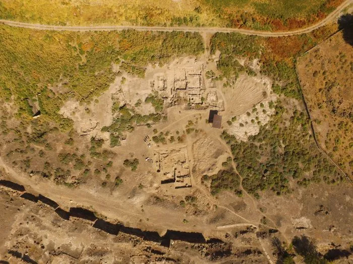
An international archaeological expedition of Georgian National Museum has been working on the Alazani Valley, in the village of Jugaani, Signagi Municipality. Archaeological excavations revealed the palace remains dating to about the 5th-4th centuries BC.

The archaeological division of the Georgian National Museum, as a result of geophysical exploration on about one hectare, found remains on the Alazani Valley that had been presumably burned.

Archaeological excavation revealed a complex planning structure – the central six-column hall of the palace.

The 1.5 metres thick walls are built of mud brick. Wooden columns of the hall stood on limestone, bell-shaped bases.

There have also revealed square podiums built of mud bricks, where a throne or altar may have stood.

The bell-shaped bases, as well as the architectural elements discovered on the same site – presumably part of the decor of the column capitals – suggests that the building is from the Achaemenid era and dates back to the 5th-4th centuries BC.

It is known that the bell-shaped bases were developed at the beginning of the 5th century BC in the centres of the Persian Empire of the Achaemenids – in Sousa and Persepolis and the lotus ornament is also typical of Achaemenid art.

A domed structure, located about two kilometres from the newly discovered building, also dates to the 5th century BC. This structure was excavated in 1994-1995 and is on display at the Georgian National Museum at Signagi.

The remains of the newly discovered palace lie some forty centimetres from the surface of the ground and have been heavily damaged by ploughing.

 The bell-shaped bases seem to have been damaged by fire and only at the bottom of some bases remain.

The head of the Georgian-German International Archaeological Expedition from the German side is Dr. Kai Kanyut (from the University of Munich Ludwig Maximilian) and Iulon Gagoshidze from the Georgian side (scientific consultant of Georgian National Museum).

The expedition involved a team of German geophysicists led by Jorg Fassbinder; Students from Ivane Javakhishvili Tbilisi State University and Munich University students participated in the excavation.

7,000-Year-Old Underwater Road Discovered In Adriatic Sea Off Korcula Island

7,000-Year-Old Underwater Road Discovered In Adriatic Sea Off Korcula Island


Visitors to the beautiful island of Korcula, the supposed birthplace of Marco Polo in Croatia, can admire wonderful dense pine forests,  beautiful buildings, small squares, and marvelous monuments in the medieval Old town. 

As the sixth-largest Adriatic island, Korcula is a popular tourist attraction, but the island has more to offer than modern sightseeing tours. The island of Korcula has a rich history going as far back as the Stone Age.

A local legend tells Prince Antenor of Troy founded the main settlement of Korcula. Archaeologists have previously found evidence of ancient Greek settlements on the island, and Korcula was also once part of the Roman Empire.

Now, underwater archaeologists have made an incredible find making the history of Korcula even more exciting.

Scientists from the Univerity of Zadar announced on Facebook they made a surprising discovery while conducting underwater archaeological research on the submerged Neolithic site of Soline on the island of Korcula.

The research is the result of the collaboration of several institutions and companies.

In addition to the leader Mata Parica from the University of Zadar, the group consisted of Domagoj Perkić (Museums of Dubrovnik), Ivan Šuta and Vedran Katavić (Museum of the City of Kaštela), Katarina Batur (University of Zadar), Marta Kalebota ( City Museum of Korčula), Eduard Visković (Kantharos), with the assistance of Dalibor Ćosović from the diving center Lumbard Blue.

At the same time, on the other side of the island of Korcula, archaeologists from the University of Zadar are conducting land research near Gradina Bay near Vela Luka. It was Igor Borzić, the head of the research, who noticed the strange structures in the sea of the bay.

The archaeological team diving at the Soline site inspected the central part of Gradina Bay.

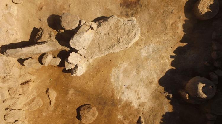
To everyone’s delight, the existence of a settlement almost identical to the one at Soline was determined at a depth of 4 to 5 meters. Neolithic artifacts such as flint blades, stone axes, and fragments of millstones were found at the site.